 Catalogue PIGMA
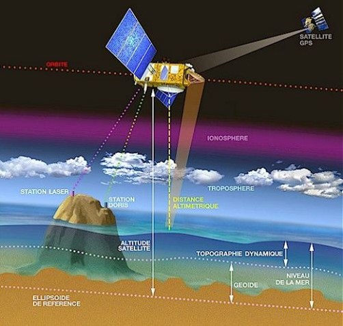
Sea surface height
Type of resources
Available actions
Topics
Keywords
Contact for the resource
Provided by
Years
Formats
Representation types
Update frequencies
status
Scale
Resolution
-
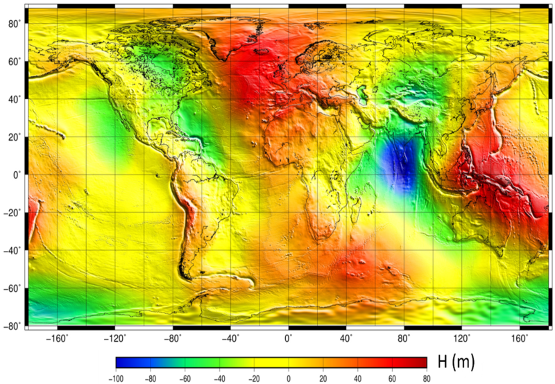
The mean sea surface (MSS) is an important field in physical oceanography, geophysics, and geodesy. In principle, it corresponds to the time-averaged height of the ocean surface. Auxiliary product : mean sea profile above a reference ellipsoid (T/P or WSG84). This surface is available on a regular grid (1/60°x1/60°, 1 minute). Another grid provides the estimation of error fields which represent the MSS accuracy estimated through the inverse technique.
-
Monomission altimeter satellite along-track sea surface heights computed with respect to a twenty-year mean. Previously distributed by Aviso+, no change in the scientific content. All the missions are homogenized with respect to a reference mission which is currently OSTM/Jason-2. The sla is computed with an optimal and centered computation time window (6 weeks before and after the date). Two kinds of datasets are proposed: filtered (nominal dataset) and unfiltered.
-
Multimission altimeter satellite gridded sea surface heights and derived variables computed with respect to a twenty-year mean. Previously distributed by Aviso+, no change in the scientific content. All the missions are homogenized with respect to a reference mission. The acquisition of various altimeter data is a few days at most. The sla is computed with a non-centered computation time window (6 weeks before the date).
-
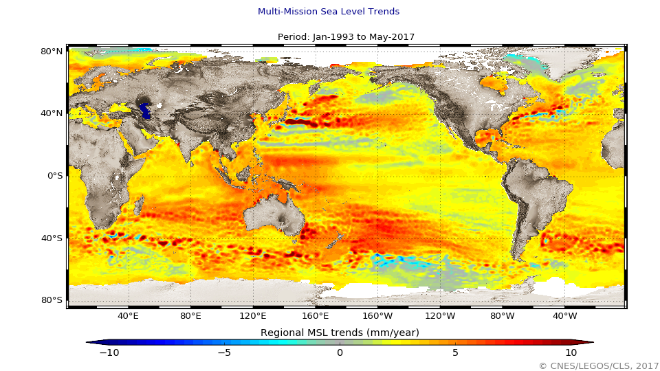
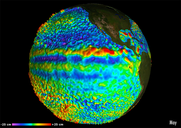
The global mean level of the oceans is one of the most important indicators of climate change. It incorporates the reactions from several different components of the climate system. Precise monitoring of changes in the mean level of the oceans, particularly through the use of altimetry satellites, is vitally important, for understanding not just the climate but also the socioeconomic consequences of any rise in sea level.
-

For the Global Ocean - Monomission altimeter satellite along-track sea surface heights computed with respect to a twenty-year mean. Previously distributed by Aviso+, no change in the scientific content. All the missions are homogenized with respect to a reference mission which is currently Jason-3. The acquisition of various altimeter data is a few days at most. The sla is computed with a non-centered computation time window (6 weeks before the date).
-
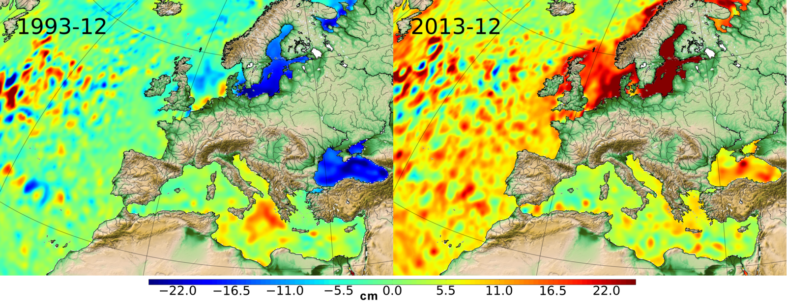
Ssalto/Duacs multimission gridded sea surface heights products. From January 1993 to the last extension of the Delayed-time products, the long delayed-time dataset allows to compute statistical means of Maps of Sea Level Anomalies (MSLA) over different periods of time. Computed with respect to a twenty-year mean profile [1993-2012], and including the seasonal variability (no annual cycle is removed).
-
Multimission altimeter satellite gridded sea surface heights and derived variables computed with respect to a twenty-year mean. Previously distributed by Aviso+, no change in the scientific content. All the missions are homogenized with respect to a reference mission. The acquisition of various altimeter data is a few days at most. The sla is computed with a non-centered computation time window (6 weeks before the date).
-
-
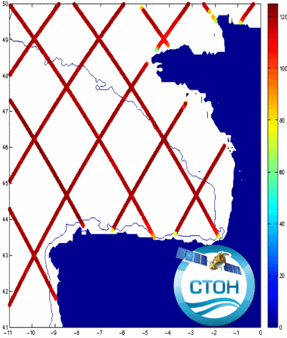
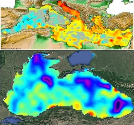
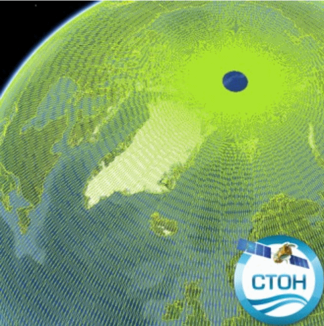
The CTOH computes and distributes specific, coastal along-track sea level anomalies (SLA) using its X-TRACK processor over 23 regions, for all precise altimeter missions : Topex/Jason-1/Jason-2/Jason-3 (+Topex Interleaved orbit (TPN)/Jason-1 Interleaved orbit (J1N)), SARAL/AltiKa, Envisat, Geosat Follow On The CTOH computes and distributes specific, coastal along-track sea level anomalies (SLA) using its X-TRACK processor for all precise altimeter missions : Topex/Poseidon (TP), Jason-1 (J1) , Jason-1 interleaved (J1N), Topex/Poseidon interleaved (TPN), Jason-2, Geosat Follow on (GFO) and Envisat. X-TRACK cover today all the coastal oceans, with 23 new regions.
-
Monomission altimeter product: OSTM/Jason-2. These products were produced by CLS in the framework of the Pistach project, funded by Cnes.