bathymetry
Type of resources
Available actions
Topics
Keywords
Provided by
Representation types
Update frequencies
status
Scale
-
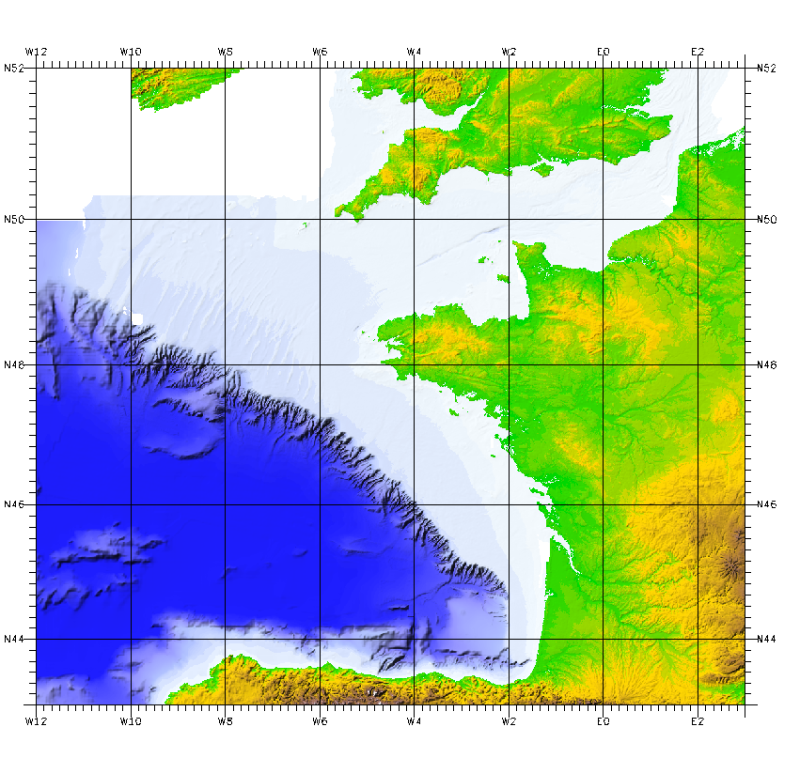
The bathymetric DEM of the atlantic facade with a resolution of 0.001° (~ 100 m) was prepared as part of the HOMONIM project. It encompasses part of the North Sea, the Channel and the Bay of Biscay. Offshore, this DTM extends beyond the slope to approximately 4800 m depth. The DEM is designed to be used in hydrodynamic models in order to produce high-precision forecasts for coastal water levels and sea conditions and therefore improve the pertinence of the Waves-Submersion monitoring programme. This product is available with the Lowest Astronomic Tide (LAT) or the Mean Sea Level (MSL) as a vertical datum.
-

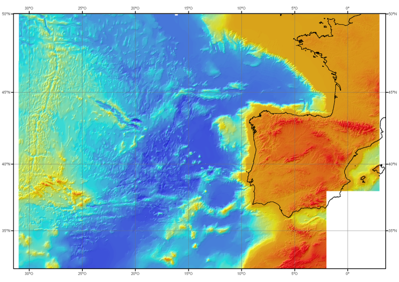
For this product, see the most recent data from the EMODnet Bathymetry project: https://emodnet.ec.europa.eu/en/bathymetry. Bathymetric model (DTM) of the North-East Atlantic, generated from conventional multibeam bathymetry data, prior to the year 2000. The grid spacing is 1000 meters. Bibliographic reference : Sibuet J.C. & al., (2004) - Carte bathymétrique de l'Atlantique nord-est et du golfe de Gascogne : implications cinématiques. Bull. Soc. géol. Fr.T. 175, n°5, pp. 429-442
-

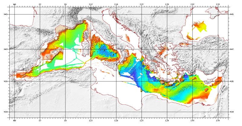
For this product, see the most recent data from the EMODnet Bathymetry project: https://emodnet.ec.europa.eu/en/bathymetry. Bathymetric model (Digital Terrain Model) of the Mediterranean. MediMap group. Bathymetry data acquired by multibeam sounders during campaigns Almofront.leg1 and Almofront.leg2, Almofront, Bretane, Seamewe2, Heralis, Medee, Anaxiprobe, Almofront2 - leg1 and leg2, Prismed2, Marmara, Fanil, Tvic5 et 6, Progres, Maradja, Blac, Nautinil, Medor-Simed1 / 2 / 3 / 4 / 5, Maradja2, Sardinia, Prisme, Assemblage and Thertou. Integration of partner organizations DTM. This DTM is available at two cell sizes : 500 meters and 1000 meters. Partners MediMap : - SHOM (service Hydrographique et Océanographique de la Marine) ; - CNRS/INSU (Centre National de la recherche Scientifique / Institut National des Sciences de l'Univers) ; - Géosciences Azur / Observatoire Océanologique de Villefranche sur Mer ; - ENS Paris (Ecole Nationale Supérieure de Paris) ; - UBO/IUEM (Université de Bretagne Occidentale / Institut Universitaire Européen de la Mer) - UP (Université de Perpignan / Laboratoire d'Etudes des Géo-environnements Marins) ; - UB/GRC-GM (Universitat de Barcelona / Geociències Marines) ; - IEO (Instituto Espanol de Oceanografia) ; - IHM (Instituto Hidrografico de la Marina) ; - Instituto Andaluz de Ciencias de la Tierra / Unitat de Tecnologia Marina, CMIMA / Universidad de Granada ; - ISMAR (Istituto di Scienze Marine) ; - Istituto Nazionale di Oceanografia e di Geofisica Sperimentale OGS/RIMA ; - Università di Trieste / Università della Calabria - Scienze della Terra ; - HCMR (Hellenic Centre for Marine Research) ; - NWO (Nederlandse organisatie voor Wetenschappelijk Onderzoek / Vrije Universiteit Amsterdam ; - Israel's national Bathymetric Survey.
-

For these products, see the most recent data from the EMODnet Bathymetry project: https://emodnet.ec.europa.eu/en/bathymetry. This bathymetric model is the result of compiling data and numerical models prior to 2008 in the Bay of Biscay. These datasets are available at a resolution of 500 m and 1000 m. Contours are also available for both digital terrain model (DTM). Public access granted under certain conditions.
 Catalogue PIGMA