 Catalogue PIGMA
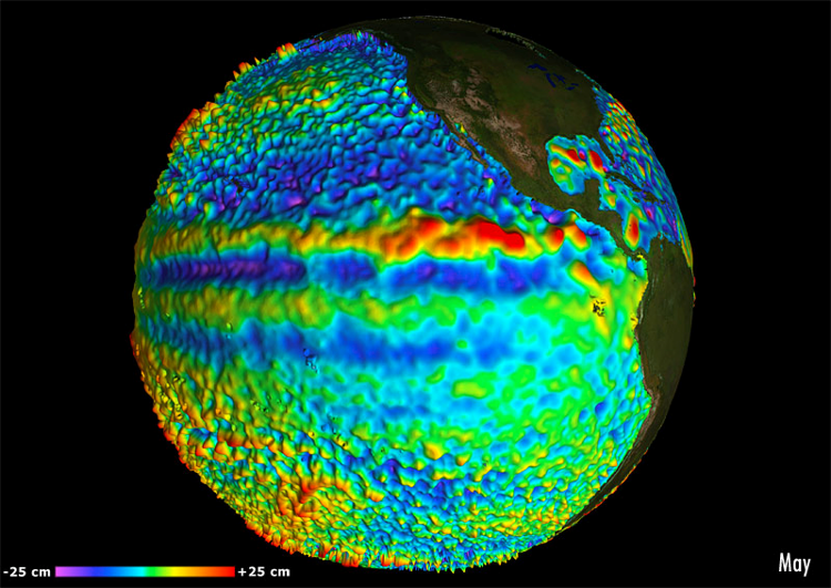
Produits altimétriques régional MSLA et MADT - Courants - Europe (multimissions, niveau 4)
Regional (Europe) gridded L4 Currents reprocessed (1993-ongoing) & NRT
Simple
-
Date (Creation)Date (Création)
- 2013-01-01
-
ReconnaissanceCredit
-
E.U. Copernicus Marine Service, AVISO+E.U. Copernicus Marine Service, AVISO+
-
Centre de données ODATIS
-
-
CDS-AVISOCDS-AVISO
-
- Keywords
-
-
Type de jeux de donnée ODATIS
-
-
/Données d'observation/satellite/Observational data/satellite
-
-
ODATIS aggregation parameters and Essential Variable names
-
-
CourantsCurrents
-
Hauteur de la surface de la merSea surface height
-
-
Access constraintsContraintes d'accès
-
LicenseLicence
-
Use constraintsContraintes d'utilisation
-
LicenseLicence
-
Autres contraintes
-
Les conditions spécifiques de la licence sont détaillées dans http://marine.copernicus.eu/services-portfolio/service-commitments-and-licence/
-
Spatial representation typeType de représentation spatiale
-
GridRaster
-
Metadata languageLangue
- Français
-
Character setJeu de caractères
-
UTF8Utf8
-
Topic categoryCatégorie ISO
-
-
OceansOcéans
-
))
- Begin date
- 2013-01-01
-
Geometric object typeType de géométries des objets
-
ComplexComplexe
-
Distribution formatFormat (encodage)
-
-
(
)
-
(
)
-
OnLine resourceRessource en ligne
- Plus d'information sur CMEMS (Europe - DT) ( WWW:LINK )
-
OnLine resourceRessource en ligne
- Accès authentifié aux données Europe DT via FTP ( WWW:LINK )
-
OnLine resourceRessource en ligne
-
ugosa ugosa
(
OGC:WMS
)
Courants géostrophiques composante zonale U - DTGeostrophic currents U - DT
-
OnLine resourceRessource en ligne
-
vgosa vgosa
(
OGC:WMS
)
Courants géostrophiques composante méridienne V - DTGeostrophic currents V - DT
-
OnLine resourceRessource en ligne
-
Plus d'information sur CMEMS (Europe - NRT) Further information on CMEMS (Europe - NRT)
(
WWW:LINK
)
Plus d'information sur CMEMS (Europe - NRT)Further information on CMEMS (Europe - NRT)
-
OnLine resourceRessource en ligne
-
Accès authentifié aux données Europe NRT via FTP Data Access (athenticated) Europe NRT through FTP
(
WWW:LINK
)
Accès authentifié aux données Europe NRT via FTPData Access (athenticated) Europe NRT through FTP
-
OnLine resourceRessource en ligne
-
vgosa vgosa
(
OGC:WMS
)
Courants géostrophiques composante méridienne V - NRTGeostrophic currents V - NRT
-
OnLine resourceRessource en ligne
-
ugosa ugosa
(
OGC:WMS
)
Courants géostrophiques composante zonale U - NRTGeostrophic currents U - NRT
-
Hierarchy levelNiveau
-
DatasetJeu de données
-
Généralités sur la provenanceStatement
-
Detailed description:
This product is processed by the SL-TAC multimission altimeter data processing system. It processes data from all altimeter missions: Jason-3, Sentinel-3A, HY-2A, Saral/AltiKa, Cryosat-2, Jason-2, Jason-1, T/P, ENVISAT, GFO, ERS1/2. It provides a consistent and homogeneous catalogue of products for varied applications, both for near real time applications and offline studies. Two resolutions are proposed (appears in the file name): *vfec* : for validated, filtered, sub-sampled and LWE-corrected data *vxxc* (named unfiltered) : for validated, NON-filtered, NON-sub-sampled and LWE-corrected data
Horizontal sampling:
1/8 degree
Detailed description:
This product is processed by the SL-TAC multimission altimeter data processing system. It serves in near-real time the main operational oceanography and climate forecasting centers in Europe and worldwide. It processes data from all altimeter missions: Jason-3, Sentinel-3A, HY-2A, Saral/AltiKa, Cryosat-2, Jason-2, Jason-1, T/P, ENVISAT, GFO, ERS1/2. It provides a consistent and homogeneous catalogue of products for varied applications, both for near real time applications and offline studies.
Horizontal sampling:
1/8 degree
-
File identifierIdentifiant de la fiche
- 62fca52c-83ed-40f1-ba6e-1c9088330b79 XML
-
Metadata languageLangue
- Français
-
Character setJeu de caractères
-
UTF8Utf8
- Parent identifier
- Global gridded L4 Currents reprocessed (1993-ongoing) & NRT 39498dd6-60fe-4377-b1ea-d0b40d2cecd3
-
Hierarchy levelType de ressource
-
DatasetJeu de données
-
Date stampDate des métadonnées
- 2024-10-15T14:43:04.394158Z
- Metadata standard name
- ISO 19115:2003/19139 - SEXTANT
- Metadata standard version
- 1.0
Overviews
Spatial extent
Provided by
