XBT
X : eXpendable; B : Bathy; T: Thermograph. Thermal profile measurement with real-time transmission
Simple
- Date (Creation)
- 1975-01-01
- Credit
- NOAA, OMM, CNRS, IRD, Ifremer
- Keywords
-
- Température
- Pression
- Salinité
- Profondeur
- Centre de données ODATIS
-
- CDS-CORIOLIS
- Type de jeux de donnée ODATIS
-
- /Observational data/in-situ
- ODATIS aggregation parameters and Essential Variable names
-
- Sea temperature
- Pressure
- Salinity
- Use limitation
- Aucune condition ne s’applique
- Access constraints
- Copyright
- Use constraints
- Other restrictions
- Other constraints
- "The XBT data are made freely available on the Atlantic Oceanographic and Meteorological Laboratory and are funded by the NOAA Office of Climate Observations."
- Spatial representation type
- Vector
- Metadata language
- Français
- Character set
- UTF8
- Topic category
-
- Oceans
N
S
E
W
))
- Begin date
- 1981-01-01
- Geometric object type
- Curve
- Hierarchy level
- Dataset
- Statement
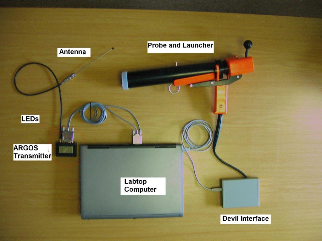
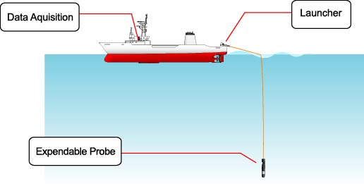
- These are disposable probes launched en route from the ship; their main interest is that they are able to get profiles quickly, without stopping the boat. The most frequently used are the XBT Deep Blue. The probe is connected to the data acquisition PC via a gun and an electronic interface. The probe contains 2000 meters of copper wire that unwinds when thrown. When it breaks at the end of the throw, the recording stops and the probe is lost. The average depth of the profiles is 800 meters. Other models exist, for shallower profiles or for faster ships.
- File identifier
- 9061d086-5803-4bbf-9c02-c8b2a79fe626 XML
- Metadata language
- Français
- Character set
- UTF8
- Hierarchy level
- Dataset
- Date stamp
- 2024-10-28T15:42:07.520267Z
- Metadata standard name
- ISO 19115:2003/19139 - SEXTANT
- Metadata standard version
- 1.0
Overviews


Spatial extent
N
S
E
W
))
Provided by

Associated resources
Not available
 Catalogue PIGMA