 Catalogue PIGMA
Copernicus Marine In Situ - Argo floats real-time currents - INSITU_GLO_UV_NRT_OBSERVATIONS_013_048
The continuously updated version of Copernicus Argo floats realtime currents product is distributed from Copernicus Marine catalogue:
The Argo current product generated by Copernicus in situ TAC is derived from the original trajectory data from Argo GDAC (Global Data Assembly Center) available at:
- Argo float data and metadata from Global Data Assembly Centre (Argo GDAC). SEANOE. https://doi.org/10.17882/42182
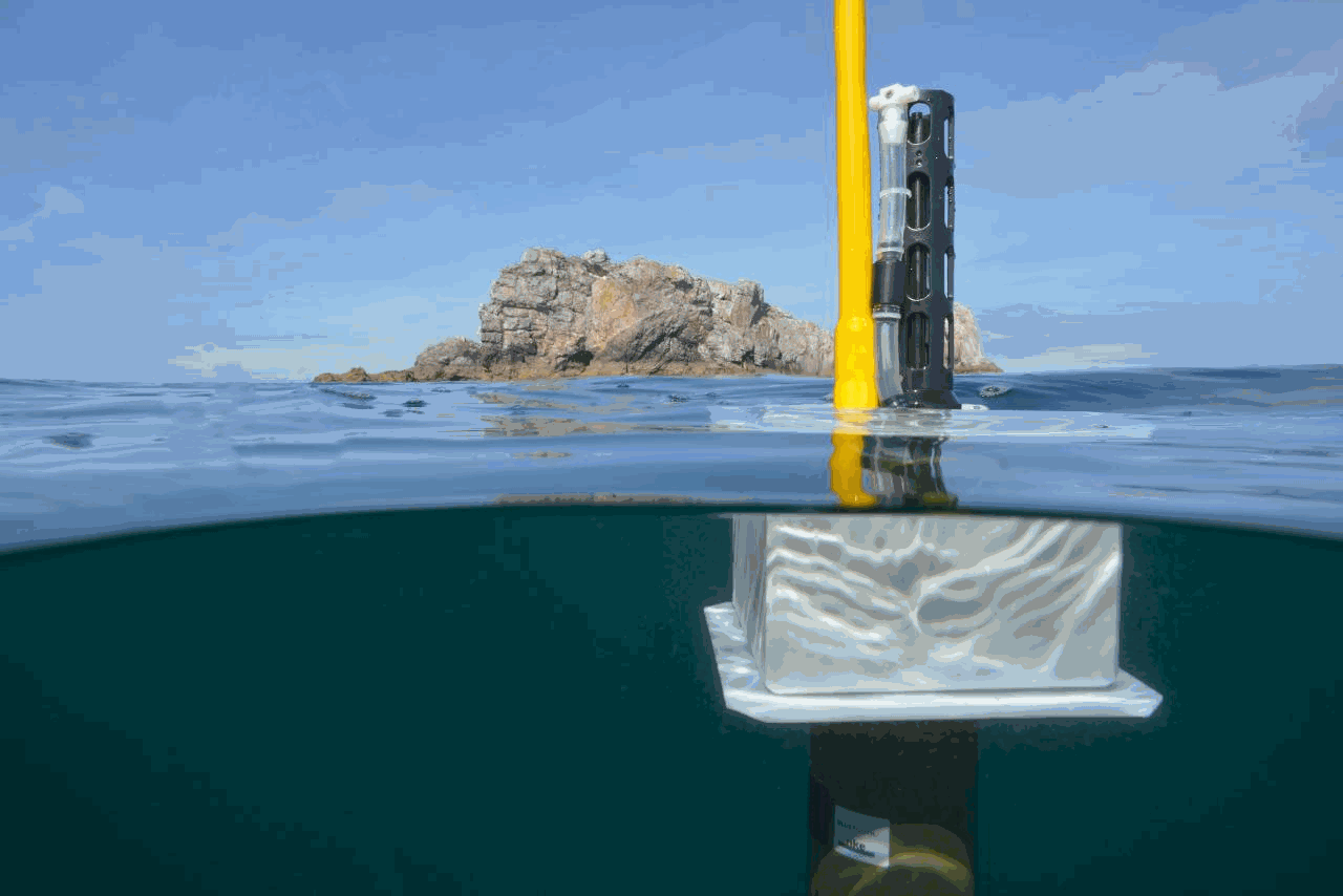
In 2021, the GDAC distributes data from more than 15,000 Argo floats. Deep ocean current is calculated from floats drift at parking depth, surface current is calculated from float surface drift.
An Argo float drifts freely in the global ocean, performing regular observation cycles.
An observation cycle usually spreads over 10 days :
- a surface descent to a parking depth (generally 1500 meters deep)
- a 10-day drift at this parking depth
- an ascent to the surface (vertical profile)
- A short surface drift for data transmission
The data transmitted at each cycle contain temperature, salinity observations (and additional biogeochemical parameters if applicable), positions (gps or argos), technical data.
The ocean current product contains a NetCDF file for each Argo float. It is updated daily in real time by automated processes.
For each cycle it contains the surface and deep current variables:
- Date (time, time_qc)
- Position (latitude, longitude, position_qc)
- Pressure (pres, pres_qc, representative_park_pressure for parking drift, 0 decibar for surface drift)
- Current (ewct, ewct_qc, nsct, nsct_qc; the current vector is positioned and dated at the last position of the N-1 cycle)
- Duration (days) of the current variable sampling (time_interval)
- Grounded indicator
- Positions and dates have a QC 1 (good data). Positions and dates that do not have a QC 1 are ignored. The positions are measured during the surface drift (Argos or GPS positioning). For the deep current of cycle N, we take the last good position of cycle N-1 and the first good position of cycle N. For the surface current of cycle N, we take the first and last good position of the N cycle.
Simple
- Date (Publication)
- 2021-12
- Date (Revision)
- 2024-03-07
- Other citation details
- Copernicus Marine in situ TAC (2021). Copernicus Marine In Situ - Argo floats real-time currents - INSITU_GLO_UV_NRT_OBSERVATIONS_013_048. SEANOE. https://doi.org/10.17882/79041
- Theme
-
- Use limitation
- CC-BY (Creative Commons - Attribution)
- Use constraints
- Other restrictions
- Date (Publication)
- 2020
- Unique resource identifier
- 10.13155/73192
- Association Type
- Cross reference
- Initiative Type
- Study
- Date (Publication)
- 2020
- Unique resource identifier
- 10.13155/59938
- Association Type
- Cross reference
- Initiative Type
- Study
- Date (Publication)
- 2019
- Unique resource identifier
- 10.13155/74324
- Association Type
- Cross reference
- Initiative Type
- Study
- Metadata language
- English
- Topic category
-
- Oceans
))
- Begin date
- 1990
- End date
- 2021
- Distribution format
-
-
NC, NETCDF
(
)
-
NC, NETCDF
(
)
- OnLine resource
-
Quality controlled data
(
WWW:DOWNLOAD-1.0-link--download
)
February 2021 snapshot - 151 MB
- OnLine resource
- Quality Information Document ( WWW:LINK )
- OnLine resource
- Product User Manual ( WWW:LINK )
- OnLine resource
- DOI of the product ( WWW:LINK-1.0-http--metadata-URL )
- OnLine resource
- Seanoe ( rel-canonical )
- Hierarchy level
- Dataset
- File identifier
- seanoe:79041 XML
- Metadata language
- English
- Character set
- UTF8
- Hierarchy level
- Dataset
- Date stamp
- 2024-03-07
- Metadata standard name
- ISO 19115:2003/19139
- Metadata standard version
- 1.0
Overviews
Spatial extent
Provided by
