 Catalogue PIGMA
TAR
Type of resources
Available actions
Topics
Keywords
Contact for the resource
Provided by
Years
Formats
-
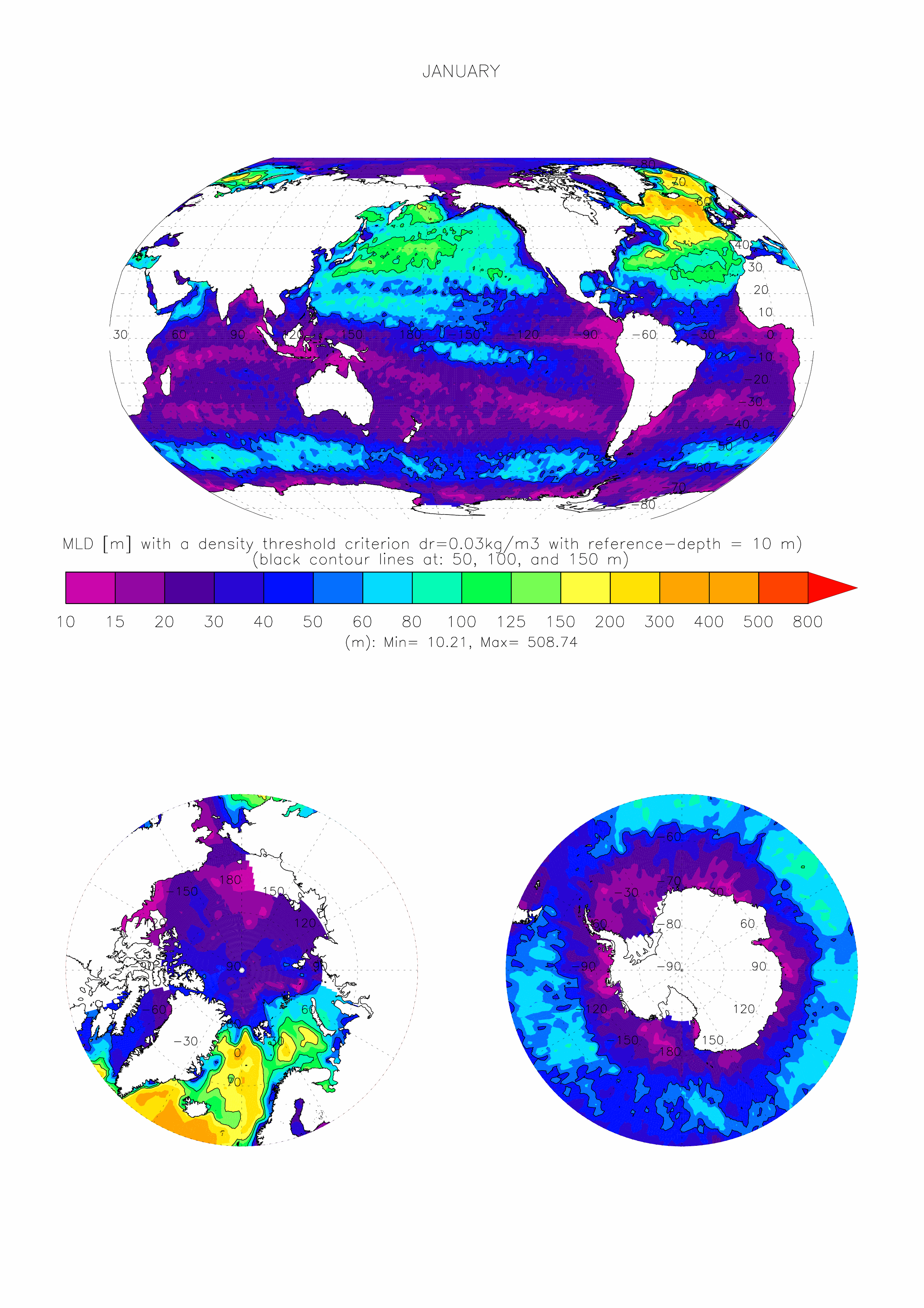
The dataset made available here is the monthly climatology (i.e. 12 months) of ocean surface Mixed Layer Depth (MLD) over the global ocean, at 1 degree x 1 degree spatial resolution. The climatology is based on about 7.3 million casts/profiles of temperature and salinity measurements made at sea between January 1970 and December 2021. Those profiles data come from the ARGO program and from the NCEI-NOAA World Ocean Database (WOD, Boyer et al. 2018). The MLD is computed on each individual cast/profile using a threshold criterion. The depth of the mixed layer is defined as the shallowest depth where the surface potential density of the profile is superior to a reference value taken close to the surface added with the chosen threshold. Here we take a threshold value for the density of 0.03kg/m3, and a surface reference depth fixed at 10m (de Boyer Montégut et al., 2004). This mixed layer is by definition homogeneous in density (up to 0.03 kg/m3 variations) and can also be called an isopycnal layer. It is especially intended for validation of MLD fields of the Ocean General Circulation Models of the ocean sciences community (e.g. Tréguier et al., 2023, Iovino et al. 2023, using v2022 of this dataset). More information and some other related datasets can be found at : https://cerweb.ifremer.fr/mld (or https://www.umr-lops.fr/en/Data/MLD redirecting to previous page).