/Biological Environment/Key Habitats/Honeycomb Worm
Type of resources
Available actions
Topics
Keywords
Provided by
Representation types
Update frequencies
status
Scale
-

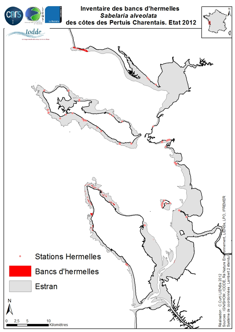
The geographical distribution of the main Sabellaria Hermelles alveolata beds (Linné, 1767) from the coast of the Pertuis Charentais was compiled from 2010 to 2012. The inventory focuses on the tidal beds (+ 6-0 m marine coast) and compiles two cartographic sources from the project CARTHAM Natura 2000 at sea of the Agency of Marine Protected Areas: 1) Hermelles inventories made on 2011 by the Association IODDE on the west of Oleron Island and 2) mapping inventory of intertidal marine habitats by LIENSs (in cooperation with CREOCEAN, Ré Nature Environnement, GEO-Transfert et la LPO Moëze-Oléron). Methodologies used by IODDE on Oléron combine ground truths with reports with Geographic Information System (GIS). The methodologies used by LIENSs to estimate the extension of the intertidal habitats throughout the Pertuis Charentais combine aerial image analysis, remote sensing, field validations by differential GPS and thematic analysis using GIS (Cajeri et al., 2012). It is during these ground truths that the presence of tackles or small Hermelles reefs was noted. The IODDE results have allowed an almost exhaustive inventory of Hermelles reefs west of Oleron. Those of LIENSs have clarified the distribution of Hermelles on most of the Pertuis Charentais foreshores.
-

Données de suivi bi-annuel de 20 récifs à Sabellaria alveolata (12 en France + 8 au Royaume-Uni et au Portugal) effectué entre 2016 et 2023 selon le protocole standardisé développé dans le cadre du projet REEHAB (pour REEf HABitat – www.hermelles.fr; Dubois et al., 2020).
 Catalogue PIGMA