/Environmental Status/Bathymetry
Type of resources
Available actions
Topics
Keywords
Provided by
Representation types
Update frequencies
status
Scale
-
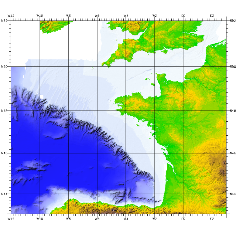
Geomorphological analysis of the continental slope of the Bay of Biscay based on a 100m Data Terrain Model (DTM). This DTM is a synthesis of data acquired during sea surveys ZEE 1, ZEE 2, Sedimanche, Sedifan 1, Sedifan 2, EssNaut 2009, EssReson08, ValidOp, BOBGeo 1, BOBGeo 2, EssInf.
-

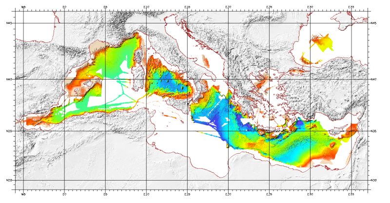
For this product, see the most recent data from the EMODnet Bathymetry project: https://emodnet.ec.europa.eu/en/bathymetry. Bathymetric model (Digital Terrain Model) of the Mediterranean. MediMap group. Bathymetry data acquired by multibeam sounders during campaigns Almofront.leg1 and Almofront.leg2, Almofront, Bretane, Seamewe2, Heralis, Medee, Anaxiprobe, Almofront2 - leg1 and leg2, Prismed2, Marmara, Fanil, Tvic5 et 6, Progres, Maradja, Blac, Nautinil, Medor-Simed1 / 2 / 3 / 4 / 5, Maradja2, Sardinia, Prisme, Assemblage and Thertou. Integration of partner organizations DTM. This DTM is available at two cell sizes : 500 meters and 1000 meters. Partners MediMap : - SHOM (service Hydrographique et Océanographique de la Marine) ; - CNRS/INSU (Centre National de la recherche Scientifique / Institut National des Sciences de l'Univers) ; - Géosciences Azur / Observatoire Océanologique de Villefranche sur Mer ; - ENS Paris (Ecole Nationale Supérieure de Paris) ; - UBO/IUEM (Université de Bretagne Occidentale / Institut Universitaire Européen de la Mer) - UP (Université de Perpignan / Laboratoire d'Etudes des Géo-environnements Marins) ; - UB/GRC-GM (Universitat de Barcelona / Geociències Marines) ; - IEO (Instituto Espanol de Oceanografia) ; - IHM (Instituto Hidrografico de la Marina) ; - Instituto Andaluz de Ciencias de la Tierra / Unitat de Tecnologia Marina, CMIMA / Universidad de Granada ; - ISMAR (Istituto di Scienze Marine) ; - Istituto Nazionale di Oceanografia e di Geofisica Sperimentale OGS/RIMA ; - Università di Trieste / Università della Calabria - Scienze della Terra ; - HCMR (Hellenic Centre for Marine Research) ; - NWO (Nederlandse organisatie voor Wetenschappelijk Onderzoek / Vrije Universiteit Amsterdam ; - Israel's national Bathymetric Survey.
-

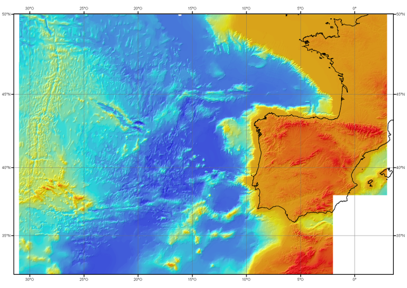
For this product, see the most recent data from the EMODnet Bathymetry project: https://emodnet.ec.europa.eu/en/bathymetry. Bathymetric model (DTM) of the North-East Atlantic, generated from conventional multibeam bathymetry data, prior to the year 2000. The grid spacing is 1000 meters. Bibliographic reference : Sibuet J.C. & al., (2004) - Carte bathymétrique de l'Atlantique nord-est et du golfe de Gascogne : implications cinématiques. Bull. Soc. géol. Fr.T. 175, n°5, pp. 429-442
-

For these products, see the most recent data from the EMODnet Bathymetry project: https://emodnet.ec.europa.eu/en/bathymetry. This bathymetric model is the result of compiling data and numerical models prior to 2008 in the Bay of Biscay. These datasets are available at a resolution of 500 m and 1000 m. Contours are also available for both digital terrain model (DTM). Public access granted under certain conditions.
 Catalogue PIGMA