/Uses and Human Activities/Fisheries and aquaculture
Type of resources
Available actions
Topics
Keywords
Contact for the resource
Provided by
Representation types
Update frequencies
status
Scale
-
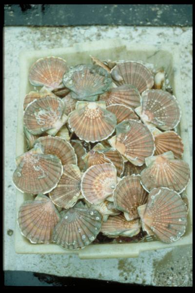
The aim of these cruises, which took place on the Thalia, was to evaluate the abundance of the scallop stock in the Charentais channels.
-

The activity calendars of fishing vessels reconstituted each year provide access to the following monthly fishing data: main operating port, number of pepole on board, number of days at sea and of, trade (s) practiced ( s), exploited fishing areas and their distance from the coast. Annual data on the dimension and mesh size of the engines used to practice a trade are also provided.
-

-
DATRAS North Sea Bottom Trawl Survey
-
-
-

-
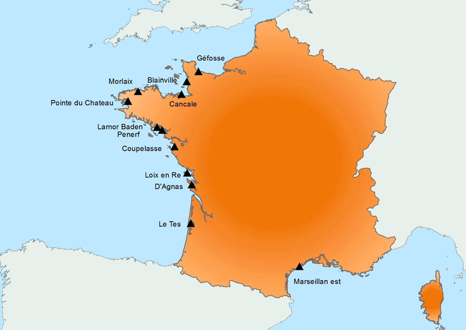
Created in 2015, it follows on from the RESCO launched in 2009, and REMORa launched in 1993. In 2015, the structure and operation of the former RESCO network was used to implement planned monitoring of oysters. More specifically, the sentinel batches used by the network, representing 3 age classes (6 months, 18 months of the previous year and 30 months of the previous year) are monitored regularly (frequency: bi-monthly or monthly). throughout the year at 12 national sites (corresponding to former RESCO sites). At each passage, counts are made to assess the mortality rate, and different types of laboratory diagnostic tests will be performed: - initially, the new spat batches (Ifremer Standardized Spats) will undergo specific PCR analyzes to search for potentially present infectious agents (OsHV-1 and Vibrio aestuarianus) but also non-specific analyzes (histology, classical bacteriology) for the possible detection of other pathogenis agents ; - for the detection of emerging diseases, the first dying batches detected for each age group, for each site, will undergo specific laboratory (OsHV-1 and Vibrio aestuarianus PCR) and non-specific (histology) diagnostic tests in order to detect as early as possible emerging diseases in these sentinel batches; - for the detection of exotic diseases, in the absence of a hierarchy of exotic diseases being available for oysters, it was decided to monitor the parasite Mikrocytos mackini because infection with this parasite is regulated at European level, on one of the RESCOII sites (Loix en Ré) previously identified as a site at risk with respect to the introduction of this parasite. In addition to these mortality follow-ups and the laboratory diagnoses, each site is equipped with a probe to allow it to gather environmental parameters (temperature, pressure, salinity) at high frequency. The various results are stored in the Quadrige² database, and are available for the various actors involved. The network is closely linked to a dedicated website which allows the dissemination of objectives, protocols and results, and which will be updated every month. In parallel, newsletters summarizing the results obtained are sent by e-mail every month to the State services.
-

-
National network for monitoring the health status of shellfish populations in natural beds or in shellfish growing areas. It performs a regulatory role and a public service activity delegated by the Ministry of Agriculture and Fisheries through the DGAL (General Directorate for Food).
 Catalogue PIGMA