 Catalogue PIGMA
Cartography
Type of resources
Topics
Keywords
Provided by
Representation types
Update frequencies
status
Scale
-
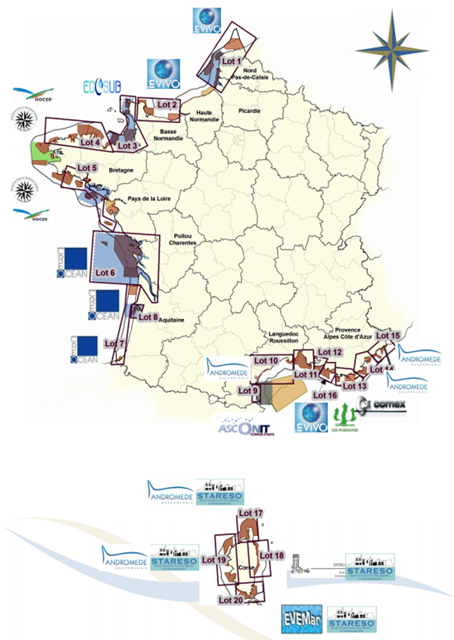
The inventory of national marine habitats in mainland France was undertaken at the request of the Ministry for Sustainable Development. Its primary objective is to meet local requirements with regards to designation of sites of ecological importance which are joining the European Natura 2000 Network as part of the “Habitat, fauna, flora” directive (DHFF) from 1992.
-
Study of dune dynamics on the French continental plate Period : First stage : 2005 to 2009 ; Second Stage : 2013-2017
-
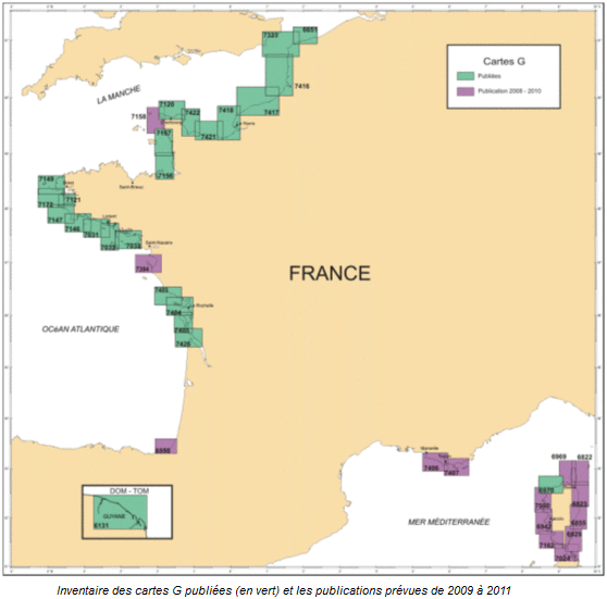
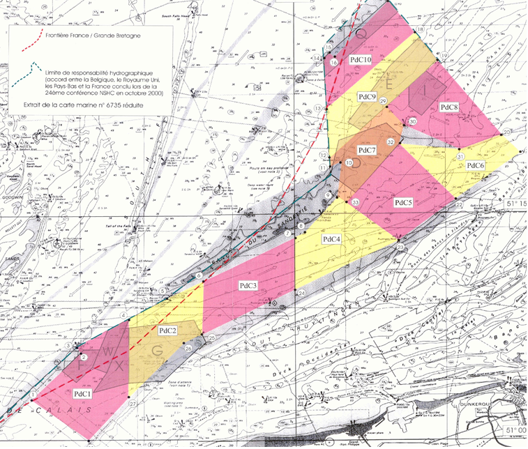
G maps represent the nature of the sea floor in the background of a maritime map used in navigation. Most such maps are published at a scale of nearly 1/50 000, and are as often as possible drawn up within the context of collaborations with university laboratories with knowledge of the area to be mapped.
-
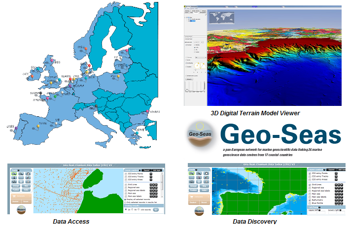
Geo-Seas is Europe-wide infrastructure for managing geological and geophysical marine and ocean data for hydrographic purposes on sites which are of interest to maritime navigation. The current description is limited to making bathymetric data available within the context of the project.