D10: Marine Litter
Type of resources
Available actions
Topics
Keywords
Provided by
Representation types
Update frequencies
status
Scale
-
-
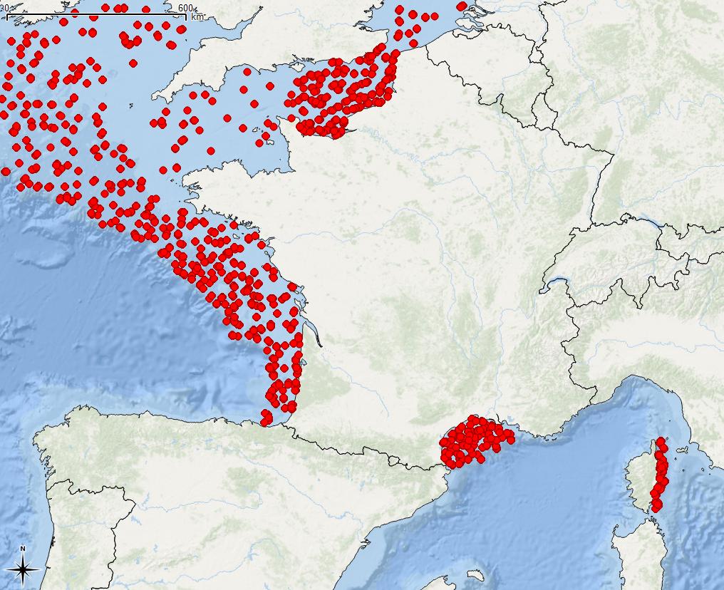
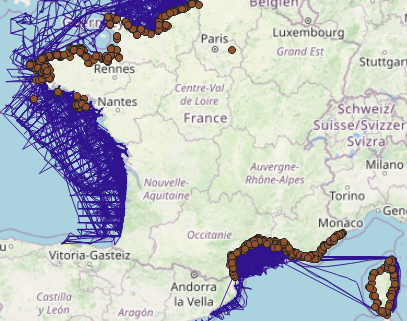
The associated data highlights the sampling programme for the data acquisition campaign of Observation on the Aerial Platform for the SAMM2 campaign (Aerial Marine Megafauna Monitoring) conducted by the PELAGIS observatory.
-
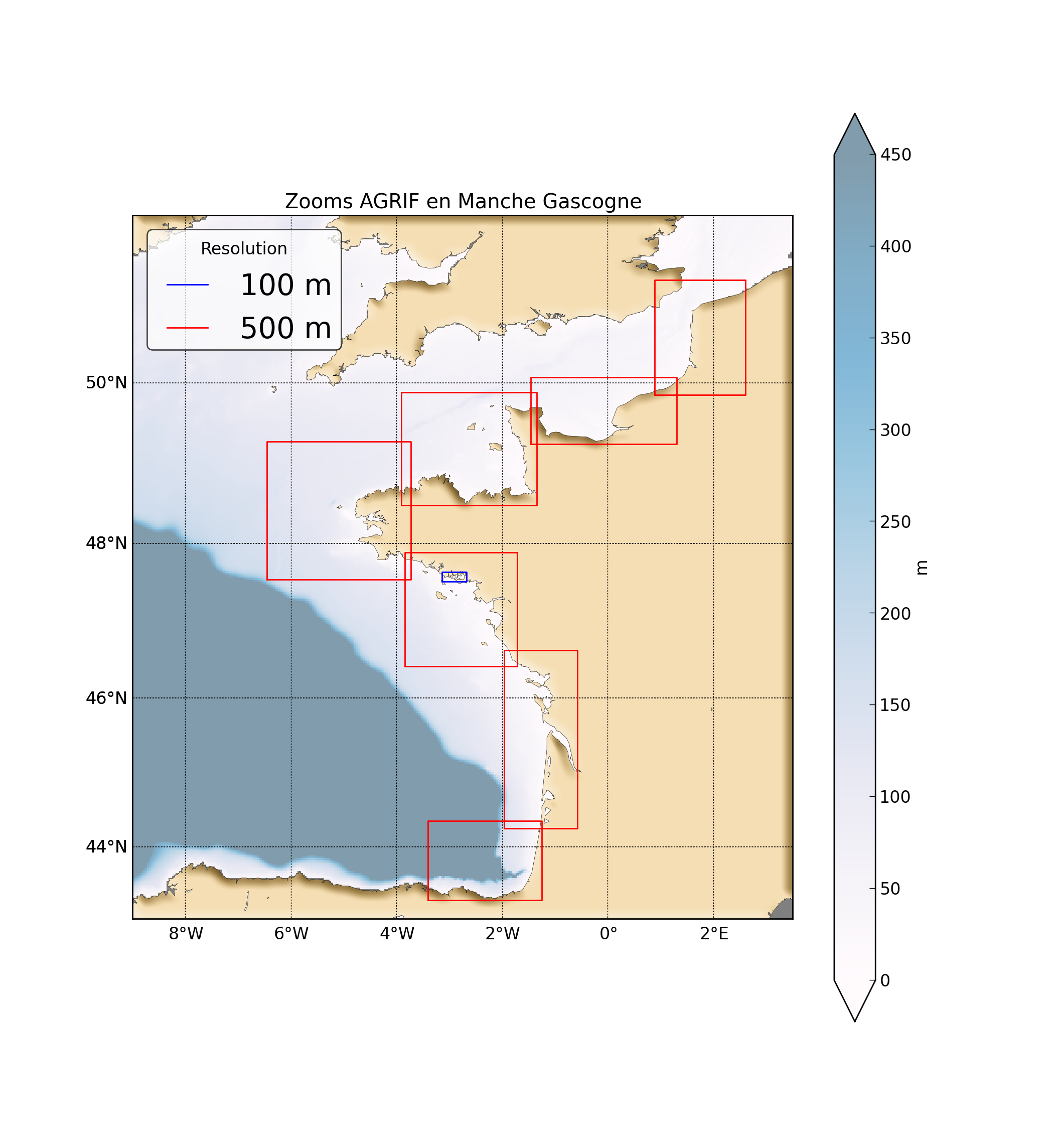
"Abstract: " Hydrodynamic database build with the MARS3D model along the french manche and atlantic coast at high spatial (500m) and temporal (1h) resolution "Details:" Seabed habitats maps are build from statistics models which need some data that describe the physical environment of the different species. Theses environmental factors are the salinity, temperature and shear stress (from waves and current) on the sea floor. Statistics are based on realistic and inter-annual simulations from 3D ocean models.Models output are currently available at a uniform resolution of 2.5 km along the whole French coast,as a part of the PREVIMER project (http://www.previmer.org) To increase the horizontal resolution of the model to 500m grid spacing, an on-line grid refinement technique has been carried out with the AGRIF library. (http://www-ljk.imag.fr/MOISE/AGRIF/) Seven zooms (with 500m resolution) have been implemented in the 2.5 km MANGAE configuration. From this configuration, an hindcast of six years (from 2010 to 2015) has been simulated and cover the french coast from spain to pas-de-calais area : "Main features of the hindcast" Horizontal resolution : 500m Vertical resolution : 40 sigma levels Temporal resolution : 1 Hour "Available physical parameters" ◦ 2D : Sea surface height and barotropic velocities (U and V components) ◦ 3D : Temperature, Salinity and baroclinic velocities
-
-
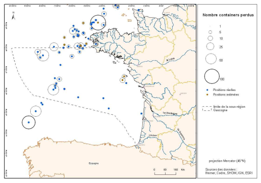
Inventory of shipping containers lost at sea (both declared and POLREPs). The Cedre continually records all the events at sea of which it is informed, and analyses the POLREP observation reports (maritime monitoring from all CROSS, navy and customs installations). The programme does not include active searching. Monitoring is therefore incomplete as it relates to past evens and pollution reports (POLREPS).
-
-
The definitive coastal information system, Quadrige stores coastal observation and monitoring network data. In order to manage coastal monitoring data, Ifremer developed the Quadrige² information system. Quadrige is one element of the Water Information System (SIE) http:// www.eaufrance.fr, et à ce titre, contribue aux travaux du Secrétariat d'Administration National des Données Relatives à l'Eau (SANDRE) http://www.sandre.eaufrance.fr. Quadrige Marine Zones is a reference source unique to the Quadrige system. It is used to break down the coast of the French mainland and overseas territories into large areas and to connect each one with observation and monitoring locations.
 Catalogue PIGMA