Keyword

Dissolved Organic Matter

9 record(s)
 
Type of resources
Available actions
Topics
Keywords
Contact for the resource
Provided by
Years
Formats
Representation types
Update frequencies
status
Scale
From 1 - 9 / 9
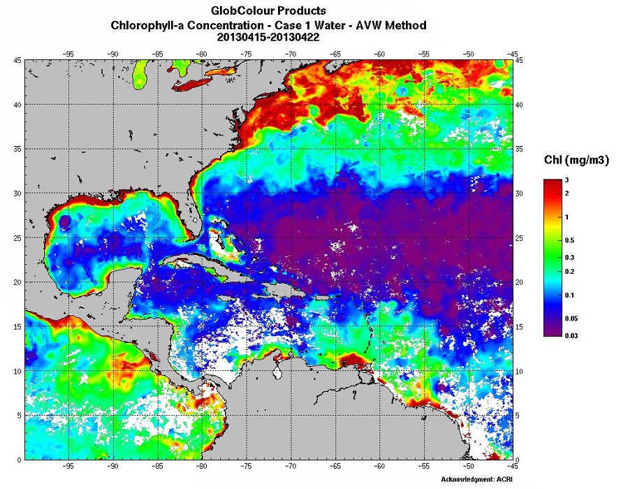
  • Biological parameters: Chlorophyll (several algorithms), Particulate Organic/Inorganic Carbon, Fluorescence…

  • The database here presented includes quality-controlled bio-optical and biogeochemical variables derived from autonomous profiling Biogeochemical Argo float measurements, and supports field and remote ocean color applications. Data represent the first optical depth (i.e., the layer of interest for satellite remote sensing) and have been collected between October 2012 and January 2016, around local noon, in several oceanic areas encompassing the diversity of ocean’s trophic environments. In addition to the first optical depth (as derived from the in situ measured depth of the euphotic layer), the presented database is compiled with data of diffuse light attenuation coefficients of photosynthetically available radiation and downward irradiance at 3 wavelengths (380, 412 and 490 nm), chlorophyll a concentration, fluorescent dissolved organic matter, and particle light backscattering at 700 nm. Associated errors to each variable are also reported.

  • The presented database includes 0-1000 m vertical profiles of bio-optical and biogeochemical variables acquired by autonomous profiling Biogeochemical-Argo (BGC-Argo) floats. Data have been collected between October 2012 and January 2016, around local noon, in several oceanic areas encompassing the diversity of ocean’s trophic environments. The database includes profiles of downward irradiance at 3 wavelengths (380, 412 and 490 nm), photosynthetically available radiation, chlorophyll a concentration, fluorescent dissolved organic matter, and particle light backscattering at 700 nm. All variables have been quality controlled following specifically-developed procedures, that aimed to support biogeochemical and bio-optical applications at the global scale. Data corruption by biofouling and any instrumental drift has also been verified. Moreover, to allow users for different biogeochemical applications, vertical profiles of chlorophyll a and particle light backscattering at 700 nm have been presented before and after advanced processing (e.g., non-photochemical quenching correction, identification of spikes). Vertical profiles of temperature and salinity associated to these bio-optical data are also provided although they have been only quality-controlled for sensor issues related to bio-fouling and instrumental drift.

  • The main purpose of the CYBER database, which supports projects selected by the Committee LEFE-CYBER, is to collect, store and disseminate data and scientific information (metadata).

  • The glider operations in the MOOSE network started to be deployed regularly in 2010 in the North Western Mediterranean Sea, thanks to the setup of national glider facilities at DT-INSU/Ifremer (http://www.dt.insu.cnrs.fr/gliders/gliders.php) and with the support of the European project FP7-PERSEUS. Two endurance lines are operated: MooseT00 (Nice-Calvi; Ligurian Sea) and MooseT02 (Marseille-Menorca; Gulf of Lion). The all dataset here corresponds to raw data in the EGO format.

  • The Ferry Box onboard Brittany Ferries’ Pont Aven vessel, which was installed in collaboration with Roscoff Marine Station, was financed by the Previmer project (CPER Bretagne funding). Within the context of this project, the data acquired by the device is used in the Previmer oceanographic models. The data can be accessed with the Coriolis oceanographic data server. Six surface parameters (temperature, salinity, oxygen content, chlorophyll fluorescence, turbidity and CDOM) are regularly measured during transects through a given area. In addition to these observations, plankton (both phyto and zooplankton are counted in the same way as for the Marine Station FerryBox installed onboard the Armorique ferry.

  • Bottle samples measurements collected during the French hydrological cruises or during joint experiments.

  • The SISMER (Scientific Information Systems of the Sea) is the Ifremer service in charge of the management of many marine databases or information systems which Ifremer is in charge of implementing.

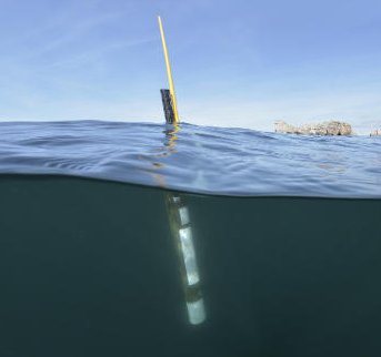
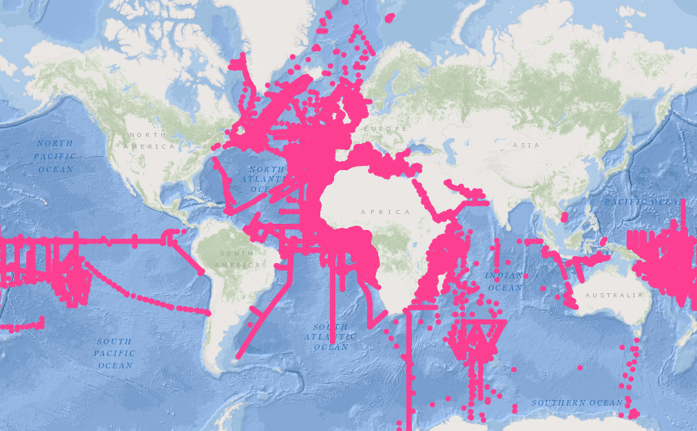
  • Argo is a global array of 3,000 free-drifting profiling floats that measures the temperature and salinity of the upper 2000 m of the ocean. This allows, for the first time, continuous monitoring of the temperature, salinity, and velocity of the upper ocean, with all data being relayed and made publicly available within hours after collection. The array provides 100,000 temperature/salinity profiles and velocity measurements per year distributed over the global oceans at an average of 3-degree spacing. Some floats provide additional bio-geo parameters such as oxygen or chlorophyll. All data collected by Argo floats are publically available in near real-time via the Global Data Assembly Centers (GDACs) in Brest (France) and Monterey (California) after an automated quality control (QC), and in scientifically quality controlled form, delayed mode data, via the GDACs within six months of collection.