 Catalogue PIGMA
Méditerranée
Type of resources
Available actions
Topics
Keywords
Contact for the resource
Provided by
Years
Formats
Representation types
Update frequencies
status
Scale
Resolution
-

Satellite image (Golfe du Lion). Satellite Synthetic Aperture Radar (SAR) imagery used for Oil Spill Detection.
-

Les sous zones de la GFCM (General Fisheries Commission for the Mediterranean) correspondent aux sous zones de la FAO pour la zone 37 (Méditerranée et mer noire)
-
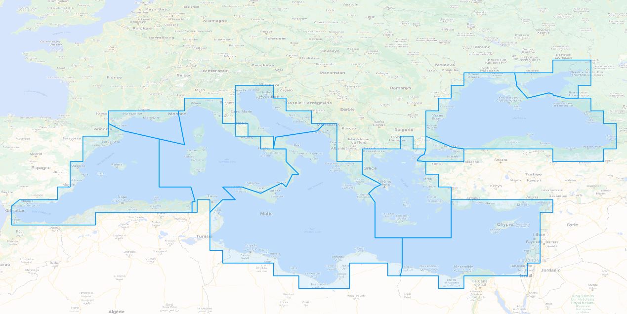
Les divisions CGPM/GFCM correspondent aux divisions de la FAO de la zone 37 (Méditerranée et mer noire).
-
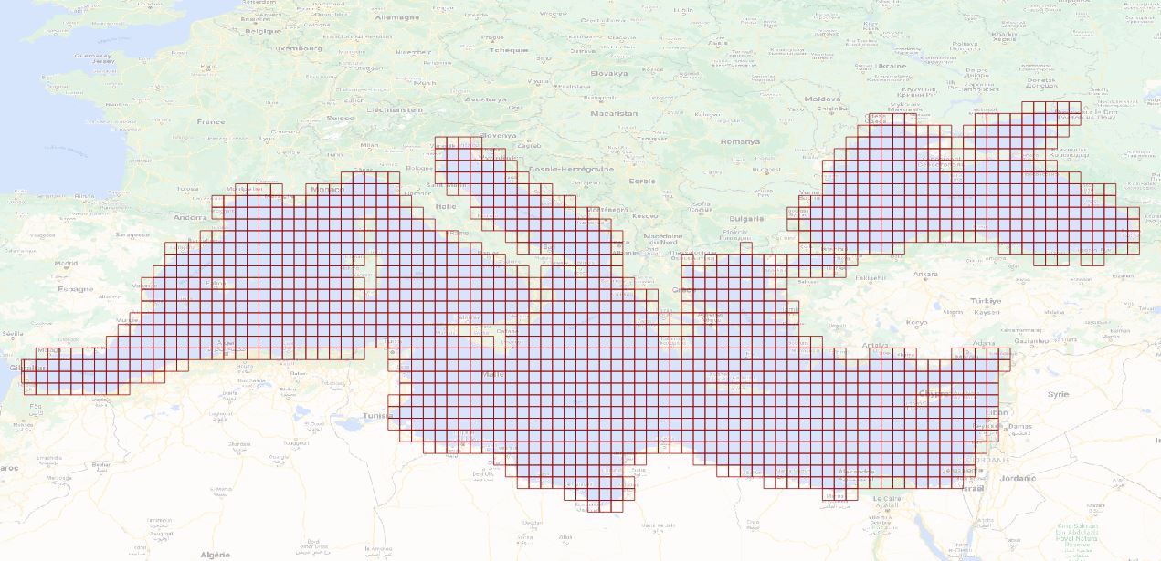
Les rectangles CGPM/GFCM correspondent à un carroyage de la zone FAO 27 (Méditerranée et mer noire) de 0.5 degrés x 0.5 degré.
-

Map of the sedimentation rates within the French metropolitan EEZ produced in the work-package 3 (seabed substrate) of the European project EMODnet Geology. This version of the dataset corresponds to the phase III of the project.
-
Aggregates map at 1 : 250 000 of the French metropolitan EEZ produced in the work-package 7 (marine minerals) of the European project EMODnet Geology. This version of the dataset corresponds to the phase IV of the project.
-

Aggregates map at 1 : 100 000 of the French metropolitan EEZ produced in the work-package 5 (coastline behavior) of the European project EMODnet Geology. This version of the dataset corresponds to the phase III of the project.
-

Physiographic domains map at 1 : 500 000 of the French metropolitan EEZ produced in the work-package 4 (sea-floor geology / geomorphology) of the European project EMODnet Geology. This version of the dataset corresponds to the phase IV of the project.
-

Geomorphologic map at 1 : 500 000 of the French metropolitan EEZ produced in the work-package 4 (sea-floor geology / geomorphology) of the European project EMODnet Geology. This version of the dataset corresponds to the phase IV of the project.
-
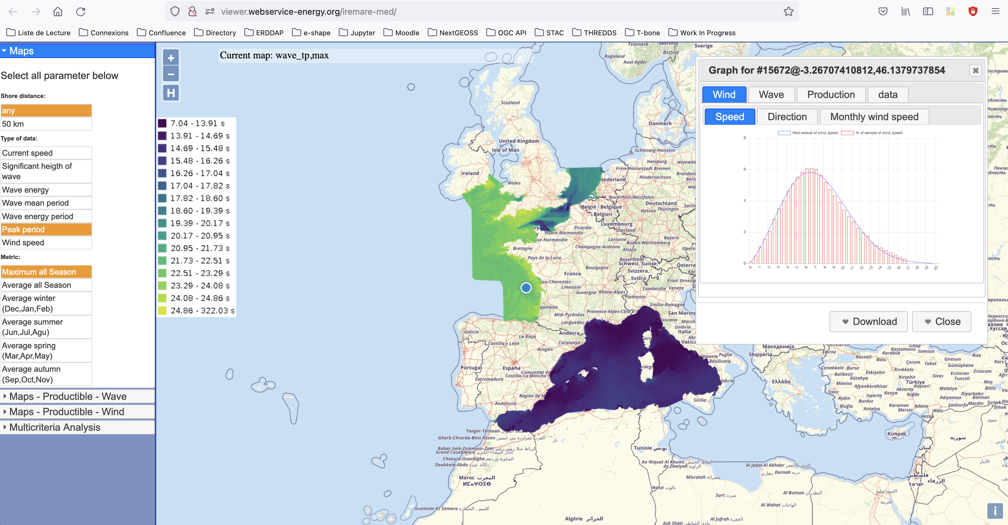
IREMARE (Marine Renewable Energie Resource Information) is a project funded by ADEME (Agency for the Environment and Energy Control, French Public Institution), convention n°1505C0027. It is dedicated to the production and dissemination of high level information about Marine Renewable Energy (MRE) resource. The information produced during IREMARE project covers the western coast of France (Atlantic, English Channel and North Sea) and can be used for national down to local scale studies. IREMARE-MED (Informations sur la Ressource pour les Energies MArines REnouvelables en MEDiterranée/Marine Renewable Energie Resource Information in the Mediterranean) is a project funded by ADEME (Agence de l'Environnement et de la Maitrise de l'Energie/Agency for the Environment and Energy Control, French Public Institution), convention n°1705C0016. It is dedicated to the production and dissemination of high level information about Marine Renewable Energy (MRE) resource. The data comes from the HOMERE database (Boudiere et al. 2013) for the zone Atlantic, Channel and North Sea and from the ANEMOC-2 dataset (Tiberi-Wadier et al. 2016) for the Mediterranean Sea.