Marine Strategy Framework Directive (MSFD)
Type of resources
Available actions
Topics
Keywords
Contact for the resource
Provided by
Formats
Representation types
Update frequencies
status
Scale
Resolution
-

The activity calendars of fishing vessels reconstituted each year provide access to the following monthly fishing data: main operating port, number of pepole on board, number of days at sea and of, trade (s) practiced ( s), exploited fishing areas and their distance from the coast. Annual data on the dimension and mesh size of the engines used to practice a trade are also provided.
-
-
"Zones homogènes de dragages" contient la donnée surfacique obtenues à partir des données créés par le BRGM, le CEREMA et issues d'un nombre limité de GPM.
-
-
Les préfets de chaque territoire définissent par arrêté préfectoral le classement des zones conchylicoles pour l’année N sur la base de la qualité REMI de l’année N-1 mais aussi de critères de qualité chimique suivis et évalués par le Réseau d’Observation de la Contamination Chimique du littoral (ROCCH). La classe retenue par arbitrage préfectoral peut différer de la qualité déterminée par le REMI, sur la base d’une décision de la commission départementale de suivi sanitaire des zones de production. La composition précise de cette commission est elle-même définie par arrêté préfectoral et peut varier considérablement d’un département à l’autre, même si elle comporte systématiquement des élus locaux, des directeurs de services territoriaux, un représentant de l’Ifremer et des représentants des professionnels. Les critères permettant ces décisions de classement par la commission ne sont pas disponibles au public et ne sont a priori pas basés exclusivement sur des données scientifiques. Dans ce classement, différentes classes de qualité sont retrouvées : A, A/B, B, B provisoire, B/C, C et N (ou Non classée). Les classes de qualité A/B et B/C désignent des zones en classement alternatif, c’est-à-dire des zones présentant visiblement une saisonnalité marquée de ses résultats de surveillance. Les classements préfectoraux sont publiés par zones, de ce fait il n’y a pas de différenciation possible au niveau de l’espèce.
-
La donnée contient la zone d'expansion maximale de la beauxite dans le canyon de Cassidaigne et du domaine bathyal environnant.
-
-
-

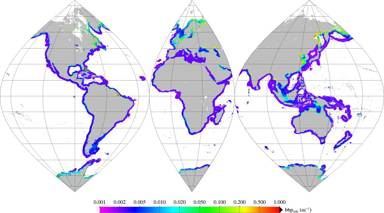
Monthly mean of backscattering coefficient (bbp) at 490nm (2002-2012) for coastal areas, at global scale, for MERIS sensor, with POLYMER atmospheric corrections. Ref: Loisel in prep.
-

 Catalogue PIGMA