 Catalogue PIGMA
SOMLIT
Type of resources
Available actions
Topics
Provided by
Years
Formats
Representation types
Update frequencies
status
Scale
-
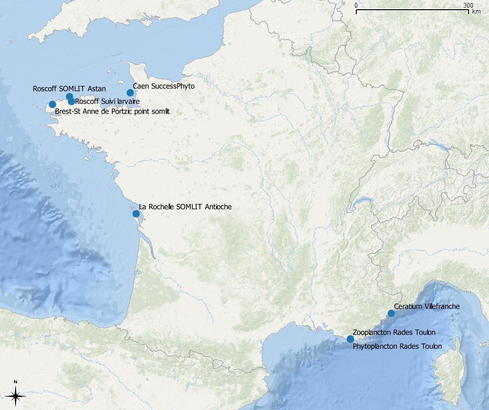
La base de données PELAGOS regroupe des données de biodiversité de l’écosystème pélagique côtier (dont des séries temporelles). L’un des objectifs est d’exploiter l’information biologique acquise, pour répondre à des questions scientifiques concernant par exemple les facteurs qui contrôlent la distribution et l’abondance des organismes pélagiques à différentes échelles spatiales et à différentes échelles de temps. Ces données présentent le suivi du site SOMLIT-Astan (Station Biologique de Roscoff) faisant partie du RESOMAR et concernent le comptage taxinomique phytoplancton (1 mètre de profondeur) de 2006 à 2015.
-
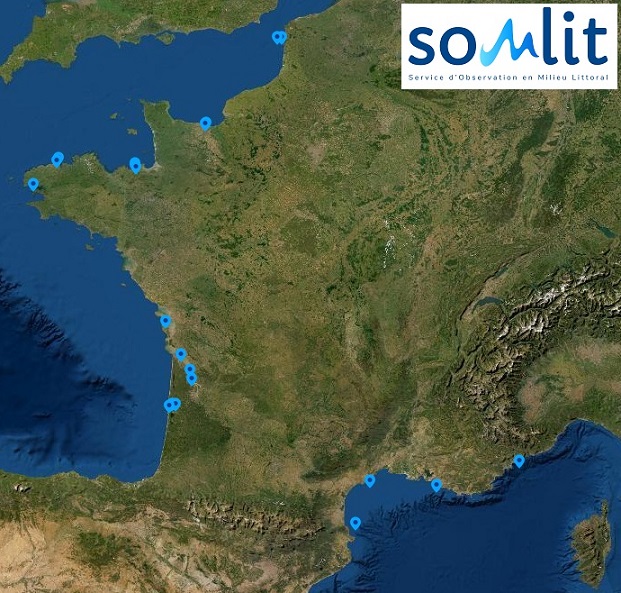
Le réseau de stations SOMLIT (Service d'Observation en Milieu LITtoral) a pour objectif d'observer à moyen et à long terme l'environnement du littoral grâce aux 20 sites répartis sur 12 stations marines autour du littoral de la métropole. Ces données de 1997 à 2021 renseignent notamment sur le suivi bi-mensuel de la température, salinité, oxygène dissous, le potentiel hydrogène (pH), concentration d'ammonium (NH4), nitrates (NO3), nitrites (NO2), phosphates (PO4), silicates (SiOH4), carbone organique particulaire (COP), azote organique particulaire (NOP), matières en suspension (MES), et chlorophylle A (Chla). Elles renseignent aussi les isotopes stables de l'azote (δN15) et du carbone (δC13) ainsi que le compartiment pico-nano-planctonique. Les profils de sonde multiparamétriques (CTD) permettent enfin de décrire l’ensemble de la colonne d’eau.
-
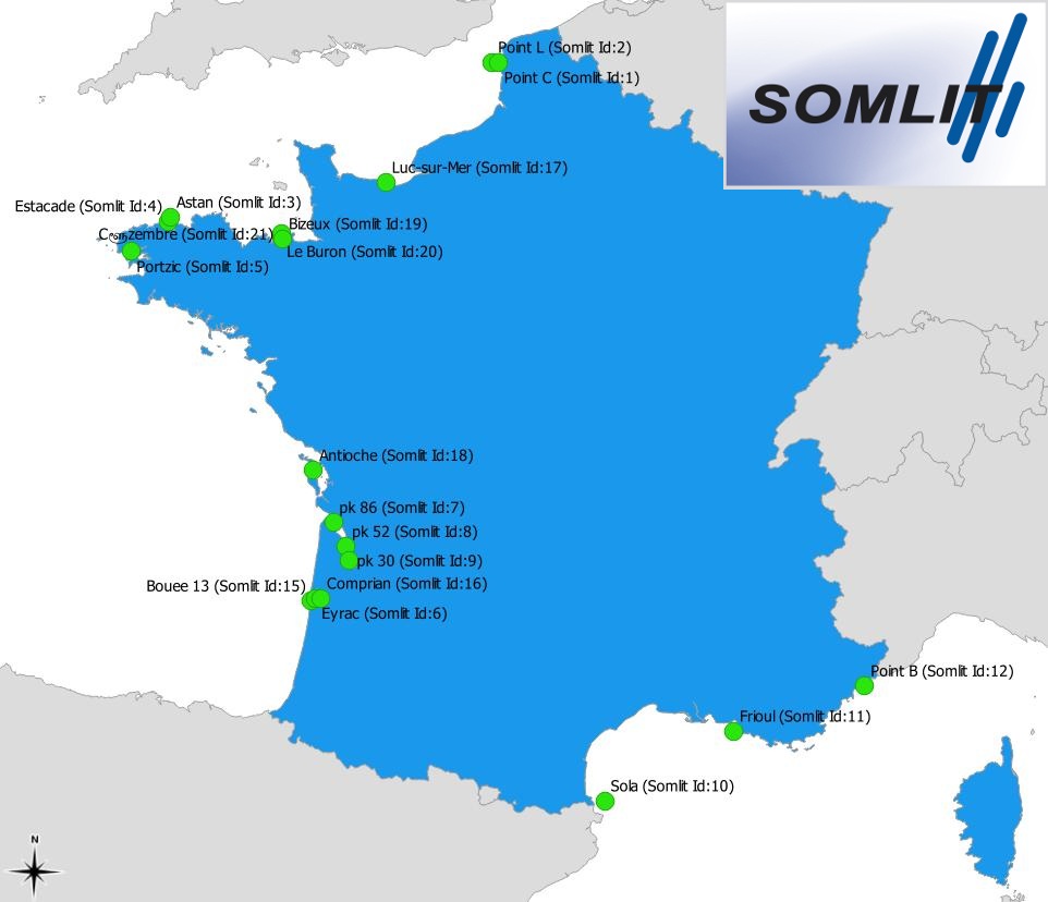
Le réseau de stations SOMLIT (Service d'Observation en Milieu LITtoral) a pour objectif d'observer à moyen et à long terme l'environnement du littoral grâce aux 19 sites répartis sur 10 stations marines autour du littoral de la métropole. Ces données de 2006 à 2016 renseignent notamment sur le suivi bi-mensuel de la température, salinité, oxygène dissous, le potentiel hydrogène (pH), concentration d'ammonium (NH4), nitrates (NO3), nitrites (NO2), phosphates (PO4), silicates (SiOH4), carbone organique particulaire (COP), azote organique particulaire (NOP), matières en suspension (MES), et chlorophylle A (Chla). Elles renseignent aussi les isotopes stables de l'azote (δN15) et du carbone (δC13) ainsi que le compartiment pico-nano-planctonique.
-
Fichier présentant les données d'origine et la méthode de détermination des coûts inhérents au volet "phytoplancton" du service d'observation en milieu marin, SOMLIT pour l'année de référence 2017
-
La problématique concerne l'impact du changement global sur les zones côtières et son importance relative par rapport aux activités humaines locales (global vs local). L'objectif général de SOMLIT est orienté vers la détection de ce forçage en zones côtières fortement influencées par les impacts locaux des activités humaines. L'étude du littoral français dans son ensemble, rendue possible par le choix de sites à situation de normalité, d'un suivi de paramètres pertinents, d'un échantillonnage bimensuel et de la mise en place d'une charte qualité, permet une approche multi-paramètres et multi-sites.