From 1 - 3 / 3
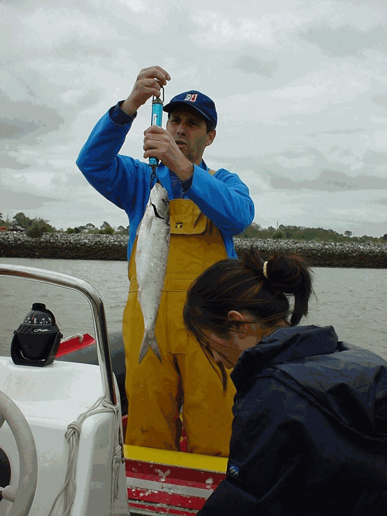
  • Data were collected by the Laboratoire de Ressources Halieutiques d'Aquitaine (Ifremer). The observations were carried out between April 1992 and July 2006. Observations and measures were made on board commercial vessels, practicing on Adour River generally in springtime and in summer. Sampling of catches took place on the river between March and July; The researchers took scales, a blood sample, took measurements of length and weight on the fish caught by the fishermen during the observed fishing trips. Sampling was of sampling-by-opportunity type. The driftnet is an emblematic and very old métier in this area, targeting different species as atlantic salmon (Salmo salar), sea trout (Salmo trutta), sea Lamprey (Pétromyzon marinus) and also allis shad (Alosa alosa). This activity is framed by particular regulation as quota of fishing days and licenses. Between 15 and 20 costal boats practice this métier during the year and the fleet characteristics are homogenous. The boats put the net in the water (around 100 m long) and let it drift with the surface current (downstream) while the tide is rising; the fish swimming upstream the river are then trapped in the water column. Different meshes can be used.

  • The aim of this project is to implement a sampling network in order to study climate variability in ocean water around the Iberian peninsula and the Bay of Biscay, to determine the flows of heat, freshwater, nutrients and C02 in wastewater, and relationship with NAO. This contributed to international climate change programmes and to the beginning of systematic study of the region. Furthermore, it facilitates the use of a digital model in the region. The main aim of the VACLAN project is to improve observation capacity and the use of the new tools available used to characterize climate change: remote sensing for the study of surface waters, drifting buoys for upper and mid waters, and moored instruments and hydrographic stations for studying the water column. The use of these tools along with digital modelling will make it possible to characterize CO2 flow and the physio-chemical flow in such a large area, where the border current is the Atlantic. Furthermore, once checked and validated, the data in this system will be made available for academic scientific communities and included in digital forecasting models.

  • The associated data highlights the sampling programme for the data acquisition campaign of Observation on the Aerial Platform for the SAMM1and SAMM2 campaigns (Aerial Marine Megafauna Monitoring) conducted by the PELAGIS observatory (UMS 3462 ULR/CNRS). The sampling plan is composed of preestablished sampling strata and transects. These were drawn up according to the specific characteristic of the study area “Mainland France”, or FrM. Description of fields and values of allocation tables: : ( - field name, meaning: value, description of values) region char 5 Study area region_lbl char 50 labelled study area idCampagne (survey) char 15 Name of the campaign programme char 20 Programme name sector char 10 Sampling sector short ID strate char 5 Sampling strata short ID strate_lbl char 15 Labelled sampling strata areaKM double Strata surface area transect_name char 10 transect sampling length_km double Transect length start_x double Coordinates of the start of transect x in decimal degree start_y double Coordinates of the start of transect y in decimal degree end_x double Coordinates of the end of transect x in decimal degree end_y double Coordinates of the end of transect y in decimal degree