 Catalogue PIGMA
Sentinel-1 wave mode
Type of resources
Available actions
Topics
Keywords
Contact for the resource
Provided by
Years
Formats
-
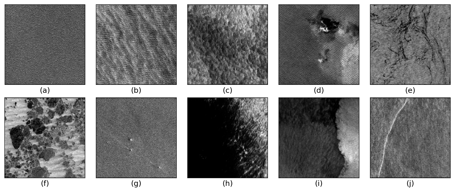
The TenGeoP-SARwv dataset is established based on the acquisitions of Sentinel-1A wave mode (WV) in VV polarization. This dataset consists of more than 37,000 SAR vignettes divided into ten defined geophysical categories, including both oceanic and meteorologic features. These images cover the entire open ocean and are manually selected from Sentinel-1A WV acquisitions in 2016. For each image, only one prevalent geophysical phenomena with its prescribed signature and texture is selected for labeling. The SAR images are processed into a quick-look image provided in the formats of PNG and GeoTIFF as well as the associated labels. They are convenient for both visual inspection and machine-learning-based methods exploitation. The proposed dataset is the first one involving different oceanic or atmospheric phenomena over the open ocean. It seeks to foster the development of strategies or approaches for massive ocean SAR image analysis. A key objective is to allow exploiting the full potential of Sentinel-1 WV SAR acquisitions, which are about 60,000 images per satellite per month and freely available. Such a dataset may be of value to a wide range of users and communities in deep learning, remote sensing, oceanography, and meteorology