 Catalogue PIGMA
Total Alkalinity
Type of resources
Available actions
Topics
Keywords
Contact for the resource
Provided by
Years
Formats
-
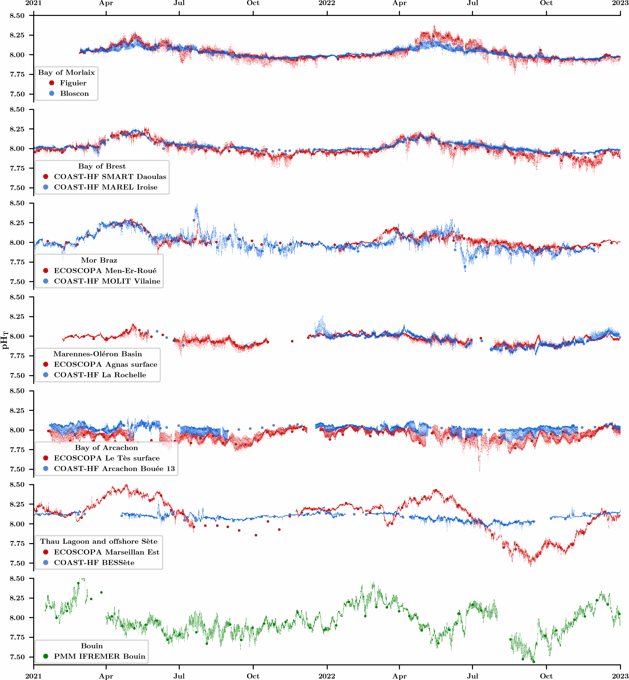
An observation network was initiated in 2021 in the framework of the CocoriCO2 project to monitore carbonate parameters along the French coastal systems. Six sites were selected along the French Atlantic and Mediterranean coastlines based on their importance in terms of shellfish production and the presence of high- and low-frequency monitoring activities. At each site, autonomous pH sensors were deployed both inside and outside shellfish production areas, next to high-frequency CTD (conductivity-temperature-depth) probes operated through two operating monitoring networks (SNO COAST-HF and Ifremer ECOSCOPA). pH sensors were set to an acquisition rate of 15 min and discrete seawater samples were collected biweekly in order to control the quality of pH data (laboratory spectrophotometric measurements) as well as to measure total alkalinity and dissolved inorganic carbon concentrations for full characterization of the carbonate system. While this network has been up and running for more than two years, the acquired dataset has already revealed important differences in terms of pH variations between monitored sites related to the influence of diverse processes (freshwater inputs, tides, temperature, biological processes).