 Catalogue PIGMA
WP6 Dynamics of ecosystem state and resources
Type of resources
Available actions
Topics
Keywords
Contact for the resource
Provided by
Years
Formats
Representation types
Update frequencies
status
Scale
Resolution
-
In August 2008, the National Geophysical Data Center (NGDC), an office of the National Oceanic and Atmospheric Administration (NOAA), developed the ETOPO1 Global Relief Model as an improvement to the ETOPO2v2 Global Relief Model. ETOPO1 is available in "Ice Surface" (top of Antarctic and Greenland ice sheets) and "Bedrock" (base of the ice sheets) versions. Both versions of ETOPO1 were generated from diverse global and regional digital data sets, which were shifted to common horizontal and vertical datums, and then evaluated and edited as needed. Bathymetric, topographic, and shoreline data used in ETOPO1 were obtained from NGDC, Antarctic Digital Database (ADD), European Ice Sheet Modeling Initiative (EISMINT), Scientific Committee on Antarctic Research (SCAR), Japan Oceanographic Data Center (JODC), Caspian Environment Programme (CEP), Mediterranean Science Commission (CIESM), National Aeronautics and Space Administration (NASA), National Snow and Ice Data Center (NSIDC), Scripps Institute of Oceanography (SIO), and Leibniz Institute for Baltic Sea Research (LIBSR). ETOPO1 is vertically referenced to sea level, and horizontally referenced to the World Geodetic System of 1984 (WGS 84). Cell size for ETOPO1 is 1 arc-minute.
-
The Task Force on Hemispheric Transport of Air Pollution (TF HTAP) is an international scientific cooperative effort to improve the understanding of the intercontinental transport of air pollution across the Northern Hemisphere. TF HTAP was organized in 2005 under the auspices of the UNECE Convention on Long-range Transboundary Air Pollution (LRTAP Convention) and reports to the Convention’s EMEP Steering Body. However, participation is open to all interested experts, both inside and outside the UNECE region. TF HTAP organizes scientific cooperation in the areas of emissions inventories and projections, analysis of ambient monitoring and remote sensing, global and regional modeling, and impact assessment to understand the intercontinental flows of ozone and its precursors, fine particles and their components, mercury, and persistent organic pollutants (POPs). The main questions of interest to the TF HTAP relate to the benefits of international cooperation to decrease air pollution emissions: - How do air pollution concentrations (or deposition) in one region of the world change as emissions change in other regions or the world? - How do changes in emissions outside a region affect the health, ecosystem, and climate impacts of air pollution within a given region? - How does the feasibility of further emissions control differ in different regions of the world?
-
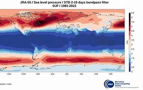
JRA55-do is a surface dataset for driving ocean-sea ice models and used in phase 2 of OMIP (OMIP-2). JRA55-do corrects the atmospheric reanalysis product JRA-55 (Kobayashi et al., 2015) using satellite and other atmospheric reanalysis products. The merits of JRA55-do are the high horizontal resolution (~55 km) and temporal interval (3 h). An assessment by Tsujino et al. (2020) implies that JRA55-do can suitably replace the current CORE/OMIP-1 dataset. This reanalysis of atmospheric variables is provided by the Japanese Meteorological Agency starting in the year 1958 and will be used to drive the coupled NEMO-ERSEM model in the hindcast configuration.
-

The dataset on Natura 2000 sites was created in 2014 by Cogea for the European Marine Observation and Data Network. It is entirely based on spatial data from the European Environmental Agency (EEA), plus additional info, links and selected EEA data joined to the feature attributes, as well as a calculation by Cogea of marine and coastal location of features. It is available for viewing and download on EMODnet - Human Activities web portal (www.emodnet-humanactivities.eu). Natura 2000 is an ecological network composed of sites designated under the Birds Directive (Special Protection Areas, SPAs) and the Habitats Directive (Sites of Community Importance, SCIs, and Special Areas of Conservation, SACs). The dataset covers the whole EU. Following the United Kingdom’s withdrawal from the EU on 31 January 2020, it ceased to be part of the EEA’s institutional networks and governance. In the webmap the EEA dataset has been filtered by Cogea to show only (i) marine sites, i.e. sites with a marine area percentage higher than 0 (as calculated by the EEA) and (ii) sites that, even if not identified as marine by the EEA, intersect the EEA coastline or that are within a distance of 1 km from the coastline (using a 1 km inner buffer from the EEA coastline). In both cases the COAST_MAR field value=1. The EEA coastline dataset is available at https://www.eea.europa.eu/data-and-maps/data/eea-coastline-for-analysis-2. Compared with the previous version, this one includes the updated dataset 'Natura 2000 End 2020', published by the EEA in July 2021. For further information (e.g. biogeographic region, directive, habitats, sites, impact, management, species and metadata) please visit the EEA's website hosting the Natura 2000 tabular data.
-
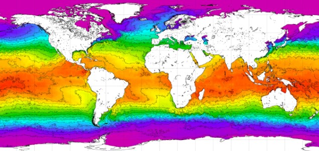
World Ocean Atlas 2018 (WOA18) is a set of objectively analyzed (one degree grid and quarter degree grid) climatological fields of in situ temperature, salinity, dissolved oxygen, Apparent Oxygen Utilization (AOU), percent oxygen saturation, phosphate, silicate, and nitrate at standard depth levels for annual, seasonal, and monthly compositing periods for the World Ocean. Quarter degree fields are for temperature and salinity only. It also includes associated statistical fields of observed oceanographic profile data interpolated to standard depth levels on quarter degree, one degree, and five degree grids. Temperature and salinity fields are available for six decades (1955-1964, 1965-1974, 1975-1984, 1985-1994, 1995-2004, and 2005-2017) an average of all decades representing the period 1955-2017, as well as a thirty year "climate normal" period 1981-2010. Oxygen fields (as well as AOU and percent oxygen saturation) are available using all quality controlled data 1960-2017, nutrient fields using all quality controlled data from the entire sampling period 1878-2017. This accession is a product generated by the National Centers for Environmental Information's (NCEI) Ocean Climate Laboratory Team. The analyses are derived from the NCEI World Ocean Database 2018.
-

The observation of sales consists of periodically measuring the size of individuals of the main species at auctions and landing points, taking into account the commercial names used at the point of sale. This system, called ObsVentes, is applied in metropolitan France and in the French overseas territories : Guyane, Guadeloupe, Martinique, Réunion and Mayotte.
-

Climatological monthly means output (physical variables) from the global hydrodynamic-biogeochemical model (NEMO-ERSEM) by the Plymouth Marine Laboratory (PML) within the framework of the project Mission Atlantic (https://missionatlantic.eu/). This 40-year monthly means netcdf file of 1 degree regular grid resolution is a sample aiming to show the results of the model in the geonode. The variables included in this netcdf are: sea water absolute salinity (so_abs, units: psu), sea water conservative temperature (thetao_con, units: C°), mixed layer depth (mldr10_1, units: m), latitude (lat, units: degrees), longitude (lon, units: degrees), time (time, units: seconds since 1900-01-01 00:00:00), depth [height] (z, units: m). The original model output files are stored with the data provider at the Plymouth Marine Laboratory.
-

The observation of catches at sea, whether landed or discarded by professional fishing vessels, provides a better understanding of the interactions between fishing activity, resources and marine ecosystems. This system, called ObsMer, is applied in metropolitan France, excluding Corsica.
-

GLODAP is an internally consistent data product for interior ocean “carbon relevant” variables, but in practice this means “everything that is measured from water samples” taken on hydrographic cruises that takes measurements of biogeochemistry, including inorganic carbon measurements. GLODAP was first published in 2004, and a new massively increased version, GLODAPv2, was published in 2016. A new version – GLODAPv2.2018 – will be published in early 2019. GLODAP have three main products: 1) A collection of individual cruise file in a consistent format and 1st level QC, 2) A product that has been bias corrected through 2nd level QC procedures, and 3) an interpolated product on a regular grid.
-
The GEBCO_2020 Grid was released in May 2020 and is the second global bathymetric product released by the General Bathymetric Chart of the Oceans (GEBCO) and has been developed through the Nippon Foundation-GEBCO Seabed 2030 Project. The GEBCO_2020 Grid provides global coverage of elevation data in meters on a 15 arc-second grid of 43200 rows x 86400 columns, giving 3,732,480,000 data points. Grid Development The GEBCO_2020 Grid is a continuous, global terrain model for ocean and land with a spatial resolution of 15 arc seconds. The grid uses as a ‘base’ Version 2 of the SRTM15+ data set (Tozer et al, 2019). This data set is a fusion of land topography with measured and estimated seafloor topography. It is augmented with the gridded bathymetric data sets developed by the four Seabed 2030 Regional Centers. The Regional Centers have compiled gridded bathymetric data sets, largely based on multibeam data, for their areas of responsibility. These regional grids were then provided to the Global Center. For areas outside of the polar regions (primarily south of 60°N and north of 50°S), these data sets are in the form of 'sparse grids', i.e. only grid cells that contain data were populated. For the polar regions, complete grids were provided due to the complexities of incorporating data held in polar coordinates. The compilation of the GEBCO_2020 Grid from these regional data grids was carried out at the Global Center, with the aim of producing a seamless global terrain model. In contrast to the development of the previous GEBCO grid, GEBCO_2019, the data sets provided as sparse grids by the Regional Centers were included on to the base grid without any blending, i.e. grid cells in the base grid were replaced with data from the sparse grids. This was with aim of avoiding creating edge effects, 'ridges and ripples', at the boundaries between the sparse grids and base grid during the blending process used previously. In addition, this allows a clear identification of the data source within the grid, with no cells being 'blended' values. Routines from Generic Mapping Tools (GMT) system were used to do the merging of the data sets. For the polar data sets, and the adjoining North Sea area, supplied in the form of complete grids these data sets were included using feather blending techniques from GlobalMapper software version 11.0, made available by Blue Marble Geographic. The GEBCO_2020 Grid includes data sets from a number of international and national data repositories and regional mapping initiatives. For information on the data sets included in the GEBCO_2020 Grid, please see the list of contributions included in this release of the grid (https://www.gebco.net/data_and_products/gridded_bathymetry_data/gebco_2020/#compilations).