 Catalogue PIGMA
West Gironde Mud Patch
Type of resources
Available actions
Topics
Keywords
Contact for the resource
Provided by
Years
Formats
-
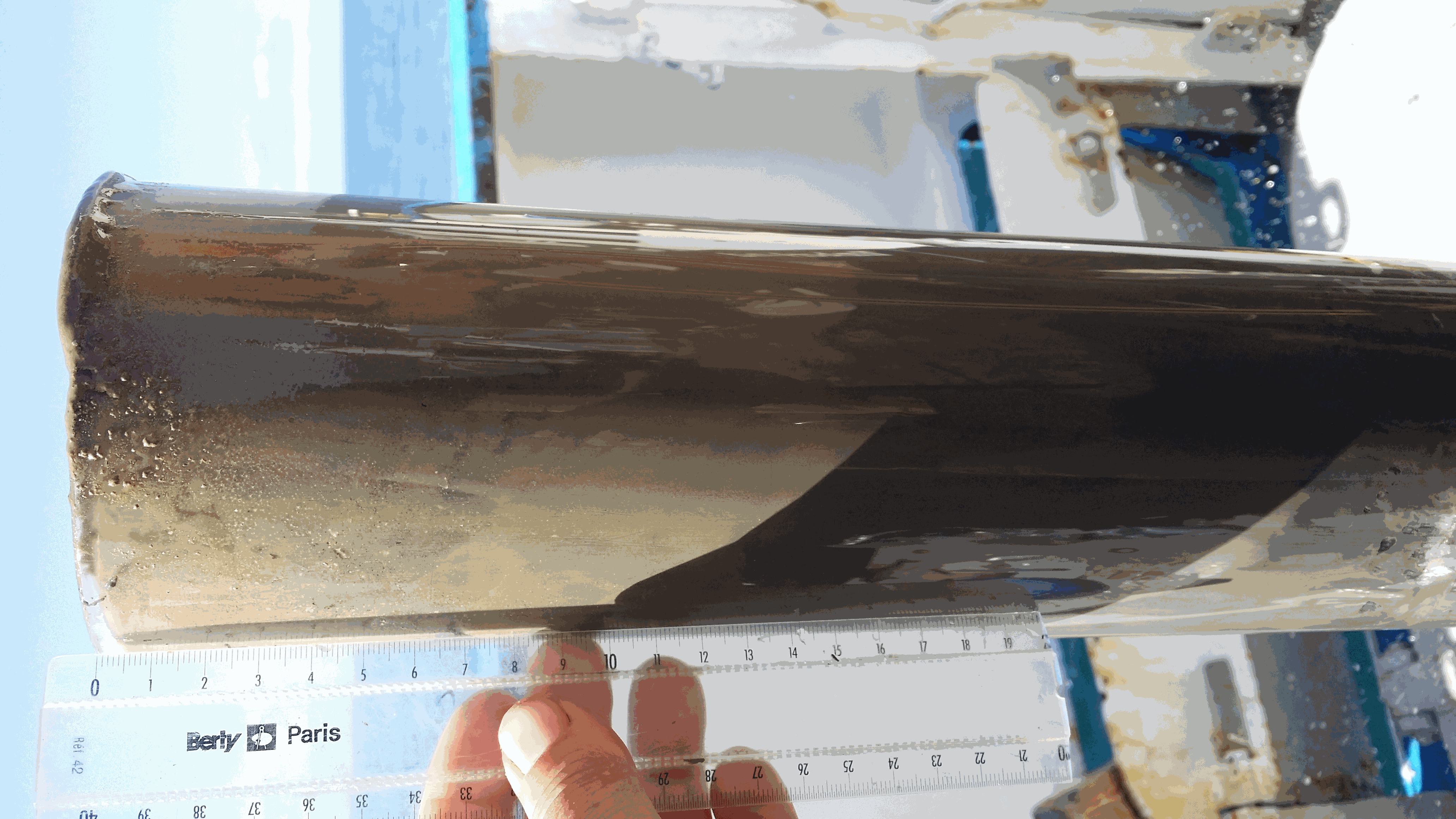
The West Gironde Mud Patch (WGMP) is a 420-km2 mud belt in the Bay of Biscay, located 25 km off the mouth of the Gironde estuary. This clay-silt feature of 4 m in thickness extends between 30 and 75m water depth, surrounded by the sands and gravels that cover the North Aquitaine continental shelf. Interface cores were collected during JERICOBent-1 cruise (October 2016; Deflandre (2016) doi.org/10.17600/16010400) along two cross-shelf transects for a total of 9 sites. Each sediment core was carefully extruded every 0.5 cm from the top core to 4 cm and every 1 cm below until the core bottom. The sediment layers were used to determine dry bulk density, grain size and selected radioisotope activities (210Pb, 226Ra, 137Cs, 228Th, K).
-

The West Gironde Mud Patch (WGMP) is a mud deposit located 25 km from the mouth of the Gironde Estuary in the Bay of Biscay. This 4-metre-thick clay-silt feature, which extends over an area of 420 km2, is found at depths between 30 and 80 meters. The main objectives of the JERICObent7 cruise, in July 2019, were to characterise the evolution of the WGMP’s benthic ecosystem in terms of its sedimentary, biogeochemical and ecological properties and to reconstruct climate variations and identify potential anthropogenic impacts over the last few centuries. To this end, a precise chronological framework was established for the sedimentary archives of the last few decades using 210Pbxs (T1/2 = 22.3 years). Interface cores were collected at stations 1, 3 and 4 along a cross-shelf transect. Twin Kullenberg cores were collected at sites 3 and 4 for geochemical (KGL) and palaeoceanographic (JB7-ST) investigations. Each interface core was carefully extruded at 0.5 cm intervals from the top of the core to 4 cm, and then at 1 cm intervals until the bottom was reached. Kullenberg cores were only collected at sites 3 and 4. Depending on their intended use, the Kullenberg cores were sampled at different resolutions, the depth of each sediment layer corresponded to the depth from the top of the core. These layers were then used to determine the dry bulk density and radioisotope activities of interest (210Pb, 226Ra, 228Th, 137Cs, 40K). Excess 210Pb was used to establish the realignment and chronological framework of the interface and Kullenberg cores.
-
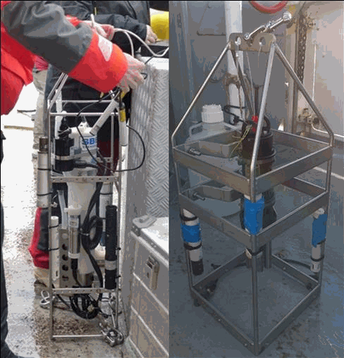
The aim of this work was to document the seasonal and inter-annual dynamic of dissolved oxygen and ancillary data (T, S, Chl-a, turbidity, pH) along a cross-shelf transect off the Gironde estuary. This work has been motivated by recent simulations that suggest the occurrence of seasonal bottom deoxygenations in this River-dominated Ocean Margin (Riomar); but unfortunately there were no data sets to test this hypothesis until now. Profiles of temperature, salinity and dissolved oxygen were performed in the water column of the West Gironde Mud Patch off the Gironde estuary (from 45°46.383’N – 1°28.925’W to 45°35.524’N - 1°50.689’W) during seven cruises on the R/V Côte de la Manche (doi: 10.18142/284 ; 10.17600/18000861) between 2016 and 2021 (October 2016, August 2017, January 2018, April 2018, July 2019, April 2021, October 2021). Turbidity was measured in January and April 2018, July 2019 and October 2021, Chl-a in October 2016, August 2017, January 2018, April 2018 and July 2019 and pH in October 2021. This dataset had permitted to validate the occurrence of bottom deoxygenations when the water column is stratified.