 Catalogue PIGMA
environmental data
Type of resources
Topics
Keywords
Contact for the resource
Provided by
Representation types
Update frequencies
status
Scale
-
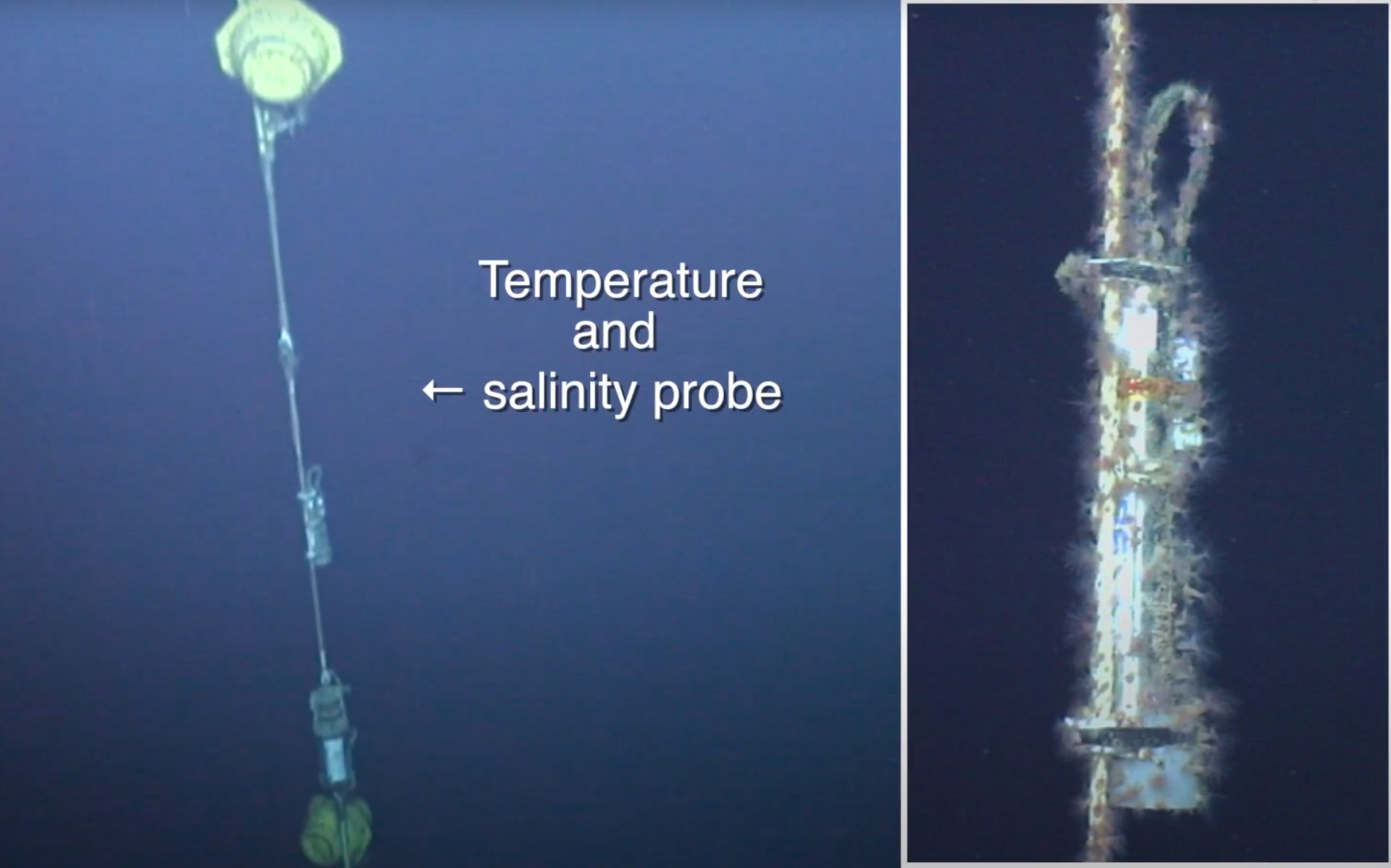
ABSTRACT : Time series of the monthly means of potential temperature, salinity and potential density recorded on the HydroChanges consecutive moorings in the Gulf of Lion (41° 59.0' N 04° 55' E) few meters above the bottom (~2320m), between 2006 and 2011. N.B.: data from 2003 to 2006 exist but moorings are yet to be recovered. Observing strategy Mooring with 1 Seacat SBE37 and usually one currentmeter. Seacat SBE37 fitted with pump and pressure sensor for accurate computation of the salinity, and mostly sent to recalibration at SeaBird after their deployment. REFERENCE : http://www.ciesm.org/marine/programs/hydrochanges.htm Schroeder K.et al., 2013. Long-term monitoring of the hydrological variability in the Mediterranean Sea: the HYDROCHANGES network. Ocean Sci., 9, 301-324, doi:10.5194/os-9-301-2013 INSTRUMENT INFORMATION : Instrument type CTD > Conductivity, Temperature, Depth Manufacturer Sea-Bird Electronics, Inc. - http://www.seabird.com Model SBE 37 Instrument features / Calibration pressure sensor, pump, recalibration Observation frequency monthly mean Longitude (°) 4.9167 Latitude (°) 41.983