 Catalogue PIGMA
fluorescence
Type of resources
Available actions
Topics
Keywords
Contact for the resource
Provided by
Years
Formats
Representation types
-
There are at least a dozen small hyper-turbid estuaries facing the Bay of Biscay, geographically situated between the two major estuaries of the Gironde and the Loire. MAGEST and SYVEL high-frequency multi-site monitoring revealed that the Loire, and to a lesser extent the Gironde, are subject to summer hypoxia. These observations raised the question of the potential occurrence of hypoxia in the small estuaries in between, motivating an investigation of dissolved oxygen in one of them, the Charente estuary. Oxygen and salinity sensors were placed at L'Houmée (2019), Tonnay-Charente (2018; 2019), Rochefort (2020; 2021; 2022), Martrou (2020) during summer, the most critical period for dissolved oxygen; a multiparameter probe was placed at Tonnay-Charente from April to November 2020. Longitudinal investigations along the estuary axis were also carried out during the summers of 2018 and 2019. All the measurements were acquired at 0.5 ± 0.2 meters below the surface. The dataset enabled us to identify the occurrence of summer hypoxia and an oxygen depletion zone in the Charente estuary. These results resulted in the implementation of high-frequency monitoring at Tonnay-Charente, operational since November 2020.
-
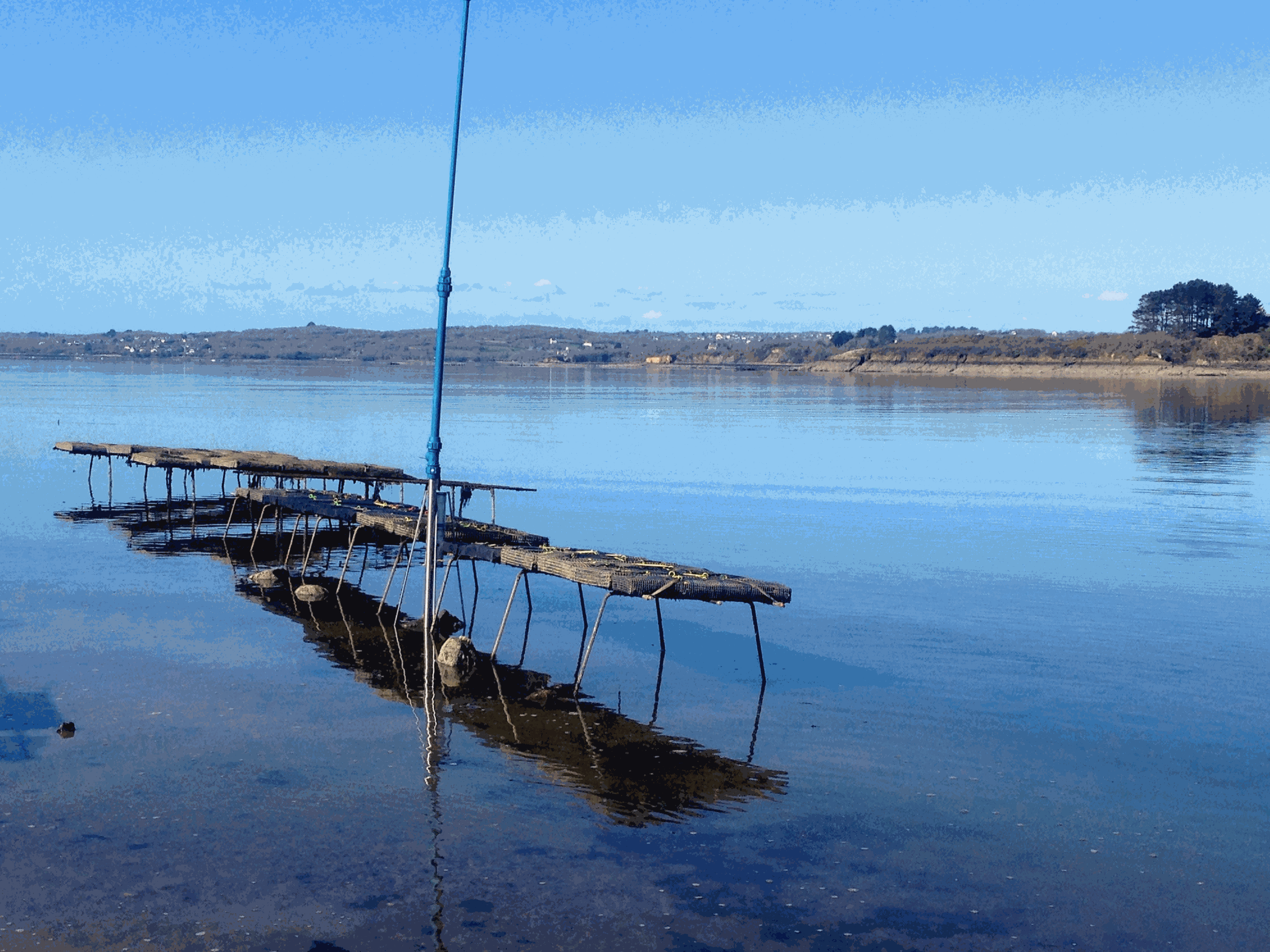
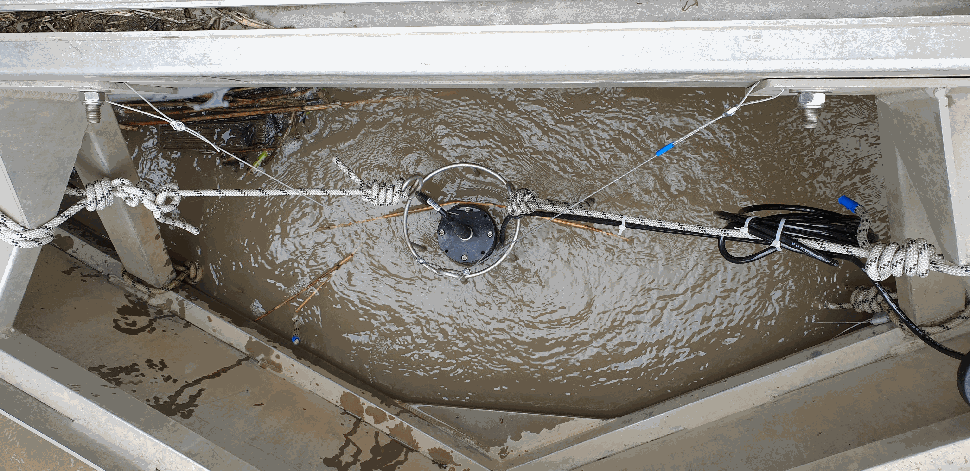
Based on the consolidation of the Ifremer networks RESCO (https://doi.org/10.17882/53007) and VELYGER (https://doi.org/10.17882/41888), the general objective of the ECOSCOPA project is to analyze the causes of spatio-temporal variability of the main life traits (Larval stage - Recruitment - Reproduction - Growth – Survival – Cytogenetic anomalies) of the Pacific oyster in France and follow their evolution over the long term in the context of climate change. The high frequency environmental data are monitored since 2010 at several stations next to oyster farm areas in eight bays of the French coast (from south to north): Thau Lagoon and bays of Arcachon, Marennes Oléron, Bourgneuf, Vilaine, Brest, Mont Saint-Michel and Veys (see map below). Sea temperature and practical salinity are recorded at 15-mins frequency. For several sites, fluorescence and turbidity data are also available. Data are acquired with automatic probes directly put in oyster bags or fixed on metallic structure at 50 cm over the sediment bottom, except for Thau Lagoon whose probes are deployed at 2m below sea surface. Since 2010, several types of probes were used: STP2, STPS, SMATCH or WiSens CTD from NKE (www.nke-instrumentation.fr) and recently ECO FLNTU (www.seabird.com). The probes are regularly qualified by calibrations in the Ifremer coastal laboratories. Precision estimated of the complete data collection process is: temperature (±0.1°C), salinity (±0.5psu), in vivo fluorescence (±10%), turbidity (±10%). The data are qualified into several levels: 0-No Quality Check performed, 1-Good data, 2-Probably good data, 3-Probably bad data, 4-Bad data, 5-Value changed, 7-Nominal value, 8-Interpolated value, 9-Missing value.
-
The in-situ TAC integrates and quality control in a homogeneous manner in situ data from outside Copernicus Marine Environment Monitoring Service (CMEMS) data providers to fit the needs of internal and external users. It provides access to integrated datasets of core parameters for initialization, forcing, assimilation and validation of ocean numerical models which are used for forecasting, analysis and re-analysis of ocean physical and biogeochemical conditions. The in-situ TAC comprises a global in-situ centre and 6 regional in-situ centres (one for each EuroGOOS ROOSs). The focus of the CMEMS in-situ TAC is on parameters that are presently necessary for Copernicus Monitoring and Forecasting Centres namely temperature, salinity, sea level, current, waves, chlorophyll / fluorescence, oxygen and nutrients. The initial focus has been on observations from autonomous observatories at sea (e.g. floats, buoys, gliders, ferrybox, drifters, and ships of opportunity). The second objective was to integrate products over the past 25 to 50 years for re-analysis purposes... Gathering data from outsider organisations requires strong mutual agreements. Integrating data into ONE data base requires strong format standard definition and quality control procedures. The complexity of handling in situ observation depends not only on the wide range of sensors that have been used to acquire them but, in addition to that, the different operational behaviour of the platforms (i.e vessels allow on board human supervision, while the supervision of others should be put off until recovering or message/ping reception)°