 Catalogue PIGMA
ocean mixing
Type of resources
Available actions
Topics
Keywords
Contact for the resource
Provided by
Years
Formats
-
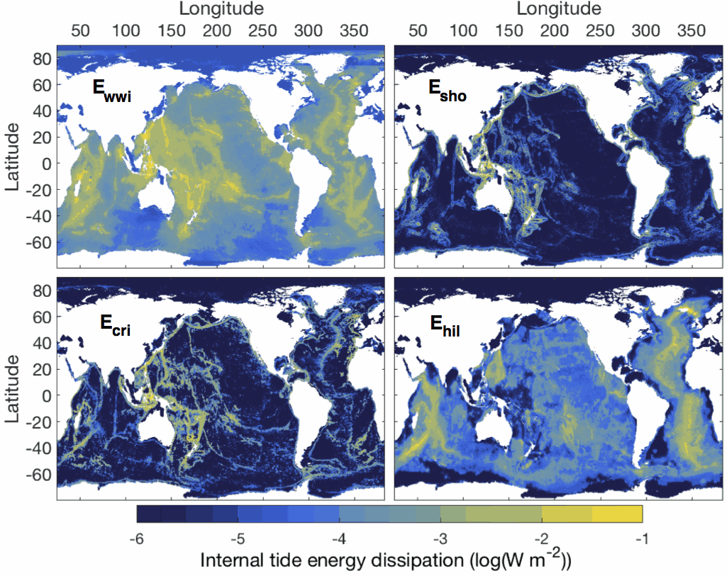
This dataset comprises two netcdf files. The first file contains the six global two-dimensional maps necessary to implement the tidal mixing parameterization presented in de Lavergne et al. (2020). Four power fields (E_wwi, E_sho, E_cri and E_hil) represent depth-integrated internal tide energy dissipation, with units of Watts per square meter. Each power field corresponds to a specific dissipative process and associated vertical structure of turbulence production. The two remaining fields, H_cri and H_bot, are decay heights (with units of meters) that enter the vertical structures of the E_cri and E_hil components, respectively. The second file contains three-dimensional fields of turbulence production (with units of Watts per kilogram) obtained by application of the parameterization to the WOCE global hydrographic climatology. The file includes the total turbulence production (epsilon_tid), its four components (epsilon_wwi, epsilon_sho, epsilon_cri, epsilon_hil), and the underlying hydrographic fields, as a function of longitude, latitude and depth. All maps have a horizontal resolution of 0.5º. Detailed documentation of the parameterization can be found in the following publication: de Lavergne, C., Vic, C., Madec, G., Roquet, F., Waterhouse, A.F., Whalen, C.B., Cuypers, Y., Bouruet-Aubertot, P., Ferron, B., Hibiya, T. A parameterization of local and remote tidal mixing. Journal of Advances in Modeling Earth Systems, 12, e2020MS002065 (2020). https://doi.org/10.1029/2020MS002065