 Catalogue PIGMA
sea water pressure
Type of resources
Available actions
Topics
Keywords
Contact for the resource
Provided by
Years
Formats
-

The observations of campe glider on imedia deployment (Mediterranean Sea - Western basin) are distributed in 4 files: - EGO NetCDF time-series (data, metadata, derived sea water current) - NetCDF profiles extracted from the above time-series - Raw data - JSON metadata used by the decoder The following parameters are provided : - Practical salinity - Sea temperature in-situ ITS-90 scale - Electrical conductivity - Sea water pressure, equals 0 at sea-level
-

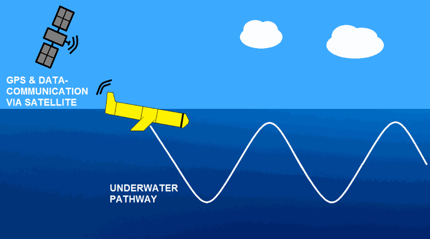
The OceanGliders initiative (formerly EGO) is a gathering of several teams of oceanographers, interested in developing the use of gliders for ocean observations. OceanGliders started in Europe with members from France, Germany, Italy, Norway, Spain, and the United Kingdom. The partners of OceanGliders have been funded by both European and national agencies to operate gliders for various purposes and at different sites. Coordinated actions are being set up for these sites in order to demonstrate the capabilities of a fleet of gliders for sampling the ocean, with a given scientific and/or operational objective. Gliders were developed since the 90’s to carry out in-situ observations of the upper 1km of the ocean, filling the gaps left by the existing observing systems. Gliders look like small autonomous robotic underwater vehicles which that uses an engine to change their buoyancy. While gliding from surface to about 1000 meters, gliders provide real-time physical and biogeochemical data along their transit. They observe temperature, salinity, pressure, biogeochemical data or acoustic data. The OceanGliders GDAC handled at Ifremer/France aggregates the data and metadata from glider deployments provided by the DACs or PIs. The OceanGliders unique DOI publishes the quaterly snapshot of the whole GDAC content and preserves its successive quaterly versions (unique DOI for easy citability, preservation of quaterly versions for reproducibility). The OceanGliders unique DOI references all individual glider deployment DOIs provided by the DACs or PIs, and with data in the GDAC. DACs or PIs may use the data processing chain published at http://doi.org/10.17882/45402 to generate glider NetCDF GDAC files.
-
The glider operations in the MOOSE network started to be deployed regularly in 2010 in the North Western Mediterranean Sea, thanks to the setup of national glider facilities at DT-INSU/Ifremer (http://www.dt.insu.cnrs.fr/gliders/gliders.php) and with the support of the European project FP7-PERSEUS. Two endurance lines are operated: MooseT00 (Nice-Calvi; Ligurian Sea) and MooseT02 (Marseille-Menorca; Gulf of Lion). The all dataset here corresponds to raw data in the EGO format.