 Catalogue PIGMA
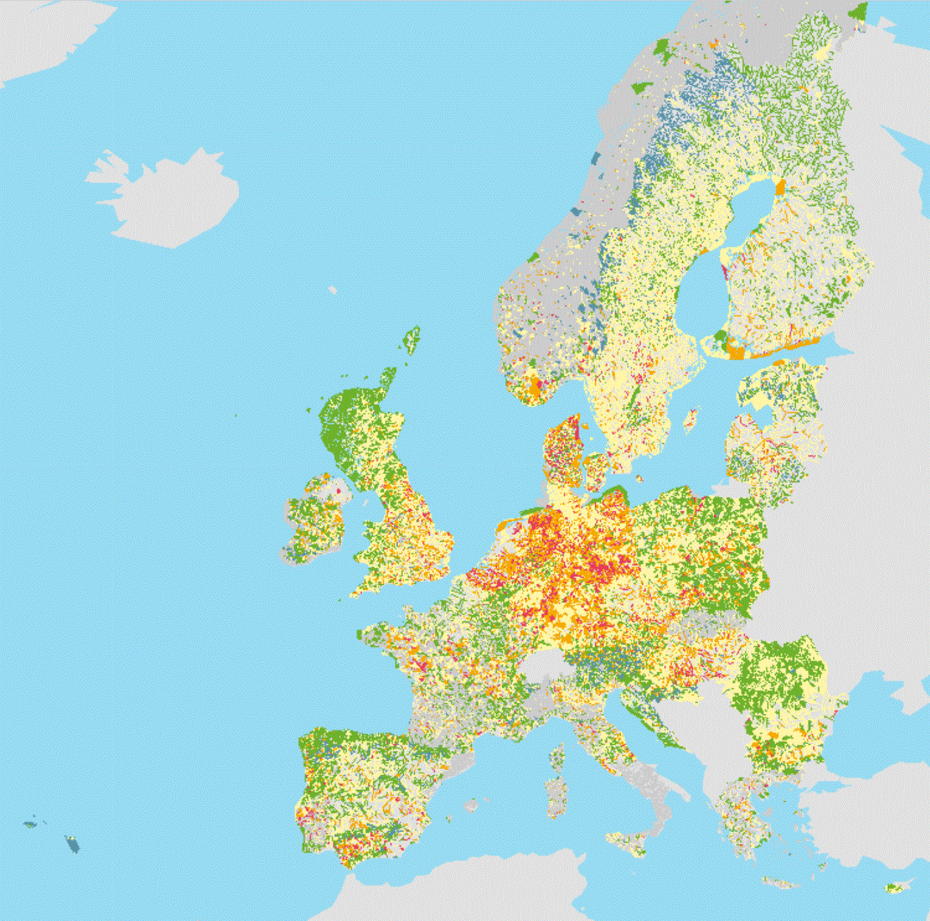
surface water
Type of resources
Available actions
Topics
Keywords
Contact for the resource
Provided by
Years
Formats
Representation types
Update frequencies
Resolution
-
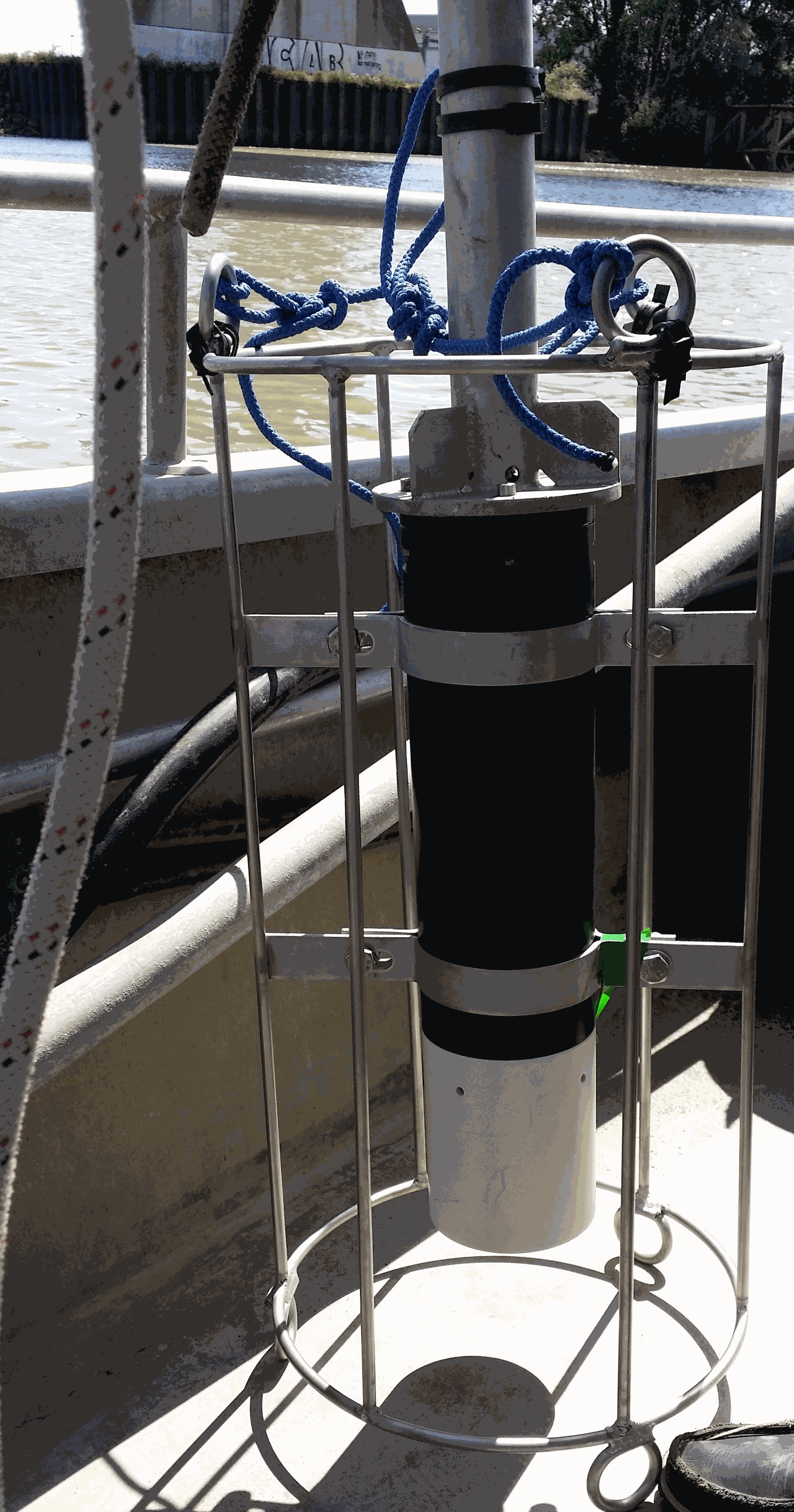
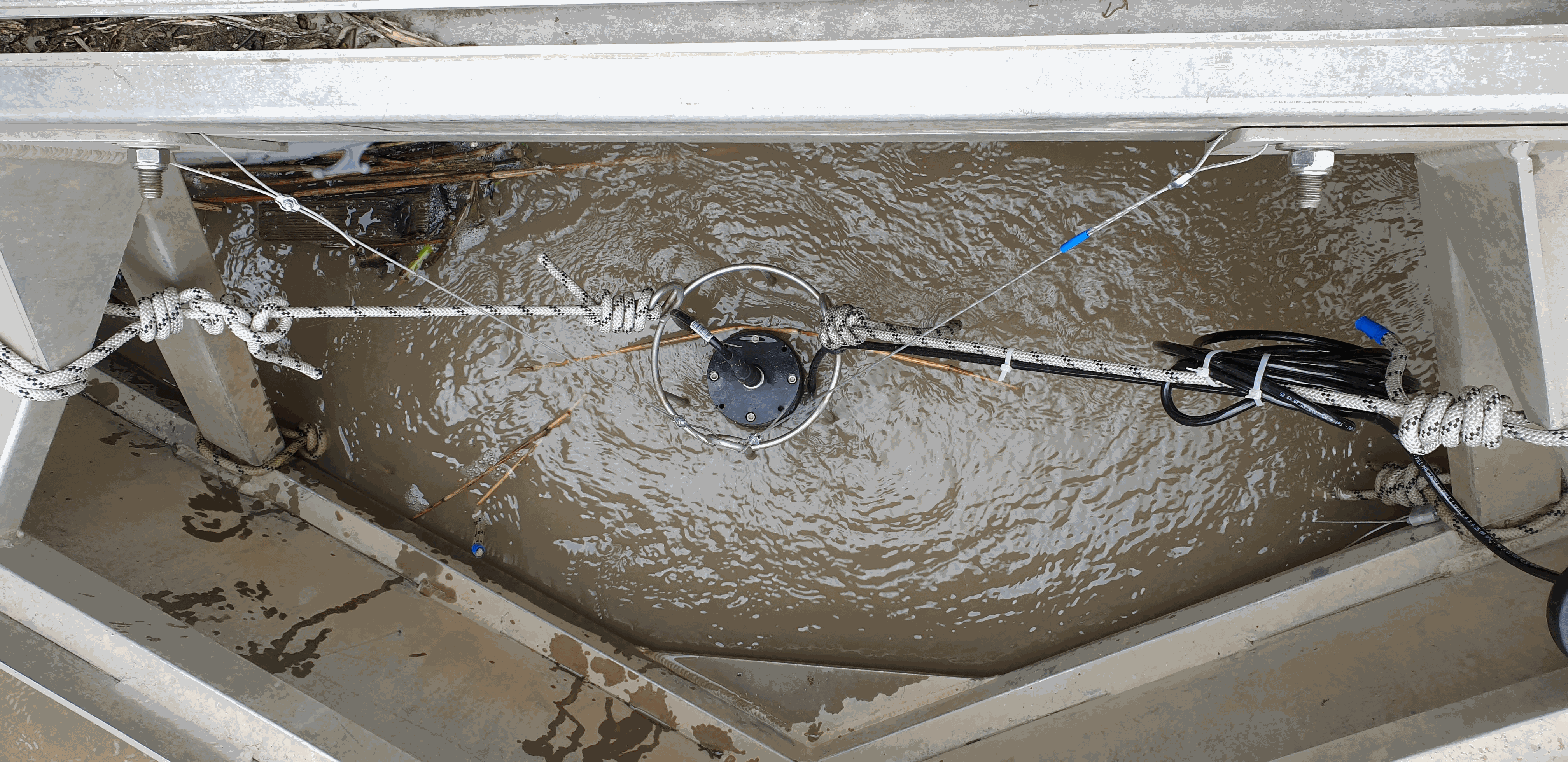
Key physico-chemical parameters (salinity, temperature, turbidity and dissolved oxygen) were measured in surface water during longitudinal transects in the Loire and Gironde estuaries in summers 2017 and 2018. This objective of this work was to determine the distribution of the dissolved oxygen and to detect potential severe desoxygenation. The transects were scheduled in order to begin the measurements at high tide from a site located upstream of an area where severe deoxygenation have been already been reported. Then, the transect was realised by sailing at low speed downstream with a multiparameter probe SAMBAT, maintained at 0.5 m below the surface, that collected a measurement every 2 minutes.
-
There are at least a dozen small hyper-turbid estuaries facing the Bay of Biscay, geographically situated between the two major estuaries of the Gironde and the Loire. MAGEST and SYVEL high-frequency multi-site monitoring revealed that the Loire, and to a lesser extent the Gironde, are subject to summer hypoxia. These observations raised the question of the potential occurrence of hypoxia in the small estuaries in between, motivating an investigation of dissolved oxygen in one of them, the Charente estuary. Oxygen and salinity sensors were placed at L'Houmée (2019), Tonnay-Charente (2018; 2019), Rochefort (2020; 2021; 2022), Martrou (2020) during summer, the most critical period for dissolved oxygen; a multiparameter probe was placed at Tonnay-Charente from April to November 2020. Longitudinal investigations along the estuary axis were also carried out during the summers of 2018 and 2019. All the measurements were acquired at 0.5 ± 0.2 meters below the surface. The dataset enabled us to identify the occurrence of summer hypoxia and an oxygen depletion zone in the Charente estuary. These results resulted in the implementation of high-frequency monitoring at Tonnay-Charente, operational since November 2020.
-
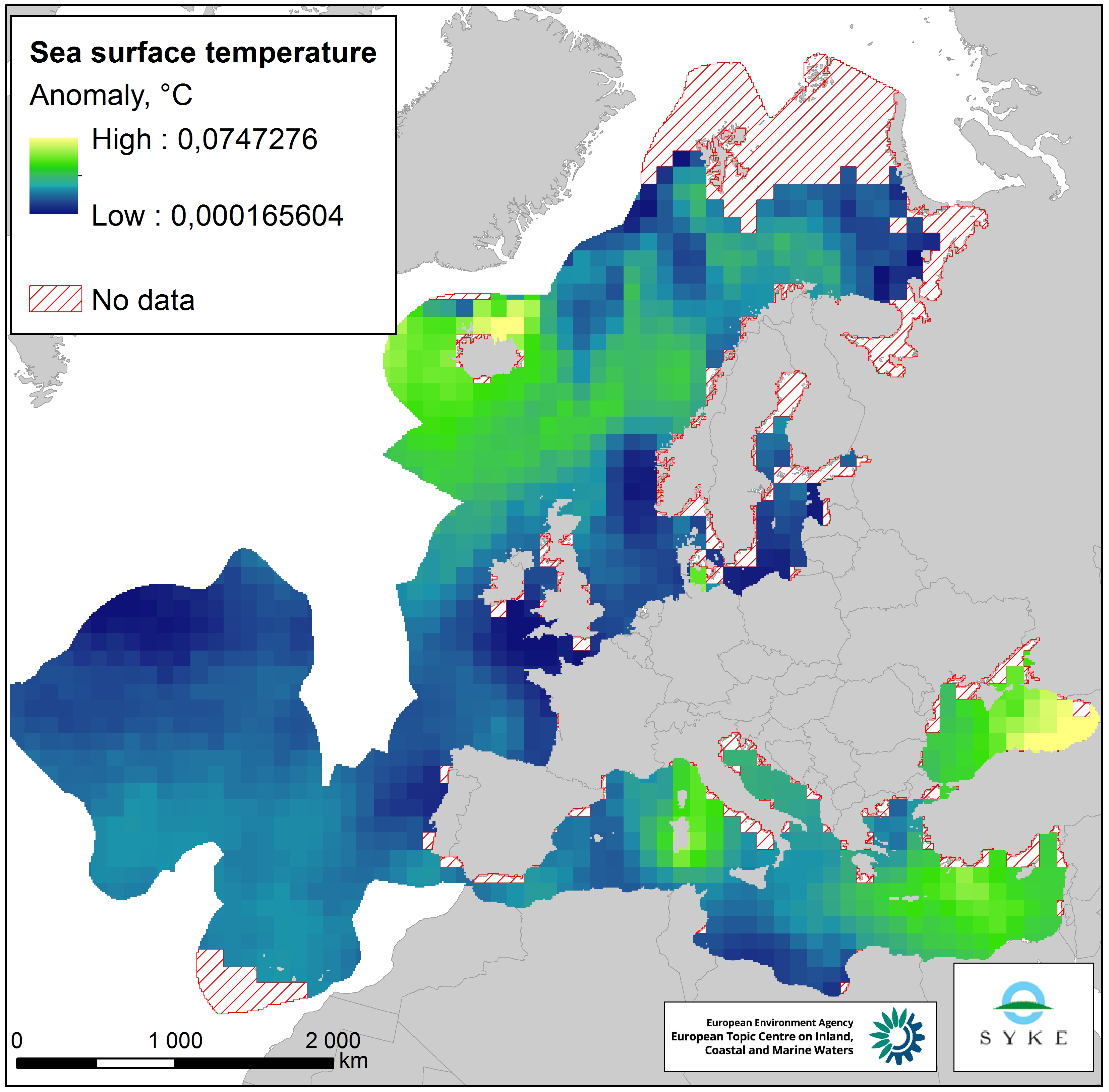
This raster dataset represents the Sea Surface Temperature (SST) anomalies, i.e. changes of sea temperatures, in the European Seas. The dataset is based on the map "Mean annual sea surface temperature trend in European seas" by Istituto Nazionale di Geofisica e Vulcanologia (INGV), which depicts the linear trend in sea surface temperature (in °C/yr) for the European seas over the past 25 years (1989-2013). Since all changes of sea temperatures can be considered to have an impact on the marine environment, the pressure layer includes absolute values of SST anomalies, i.e. negative/decreasing temperature trends were changed to positive values so that they represent a pressure. The original data was in a 1° grid format but was converted to a 100 km resolution, adapted to the EEA 10 km grid and clipped with the area of interest. This dataset has been prepared for the calculation of the combined effect index, produced for the ETC/ICM Report 4/2019 "Multiple pressures and their combined effects in Europe's seas" available on: https://www.eionet.europa.eu/etcs/etc-icm/etc-icm-report-4-2019-multiple-pressures-and-their-combined-effects-in-europes-seas-1.
-
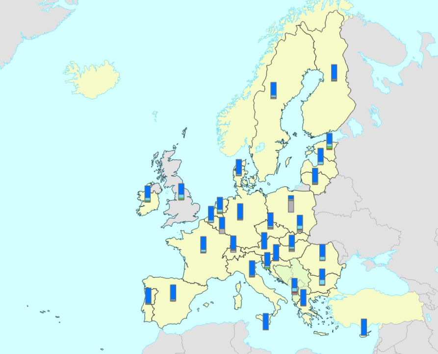
The bathing water quality data services include all coastal and inland bathing waters reported and assessed in the European Union Member States, Albania, Switzerland and the United Kingdom. The data is reported annually in the scope of the Bathing Water Directive (Directive 2006/7/EC of the European Parliament and of the Council of 15 February 2006, BWD) reporting obligations. The map services in https://water.discomap.eea.europa.eu/arcgis/rest/services/BathingWater show the location of the bathing waters and the assessment of bathing water quality for the last reported bathing season, as well as for the ten previous bathing seasons. Each bathing water is assessed for three statuses: 1) monitoring calendar status, 2) management status, 3) bathing water quality status. The monitoring calendar status evaluates the implementation of the monitoring calendar in the last reported season (as defined in Annex IV of the Bathing Water Directive). The management status evaluates the management in the last assessment period, whether the bathing water was continuously monitored or not. The bathing quality status evaluates the quality of bathing waters according to the two microbiological parameters: Escherichia coli and Intestinal enterococci (as defined in Annexes I and II of the Bathing Water Directive). The bathing water quality is classified in one of four classes: “Excellent”, “Good”, “Sufficient” or “Poor”. The status “Not classified” is applied if there are not enough available samples to evaluate the water quality. The data service in https://discodata.eea.europa.eu/ contains the results of the bathing water status since 1990: [WISE_BWD].[latest].[assessment_BathingWaterStatus] It also contains the reported data in the following tables: [WISE_BWD].[latest].[timeseries_Characterisation] [WISE_BWD].[latest].[timeseries_SeasonalPeriod] [WISE_BWD].[latest].[timeseries_MonitoringResult] [WISE_BWD].[latest].[spatial_SpatialProtected]
-
The service contains information about the ecological status or potential of European surface water bodies, delineated for the 2nd River Basin Management Plans (RBMP) under the Water Framework Directive (WFD). The Quality Element status is the poorest of the known quality element status values per water body. For example, the nutrient conditions status (QE3-1-6) is based on the following two quality elements: Nitrogen conditions (QE3-1-6-1) and Phosphorus conditions (QE3-1-6-2). The ecological status or potential is presented for the following quality elements: QE1 - Biological quality elements; QE1-1 - Phytoplankton; QE1-2 - Other aquatic flora; QE1-2-1 - Macroalgae; QE1-2-2 - Angiosperms; QE1-2-3 - Macrophytes; QE1-2-4 - Phytobenthos; QE1-3 - Benthic invertebrates; QE1-4 - Fish; QE2 - Hydromorphological quality elements; QE2-1 - Hydrological or tidal regime; QE2-2 - River continuity conditions; QE2-3 - Morphological conditions; QE3 - Chemical and physico-chemical quality elements; QE3-1 - General parameters; QE3-1-1 - Transparency conditions; QE3-1-2 - Thermal conditions; QE3-1-3 - Oxygenation conditions; QE3-1-4 - Salinity conditions; QE3-1-5 - Acidification status; QE3-1-6 - Nutrient conditions; QE3-1-6-1 - Nitrogen conditions; QE3-1-6-2 - Phosphorus conditions; QE3-3 - River Basin Specific Pollutants. The information was reported to the European Commission under the Water Framework Directive (WFD) reporting obligations. The dataset compiles the available spatial data related to the 2nd RBMPs due in 2016 (hereafter WFD2016). See http://rod.eionet.europa.eu/obligations/715 for further information on the WFD2016 reporting. Relevant concepts: Surface water body: Body of surface water means a discrete and significant element of surface water such as a lake, a reservoir, a stream, river or canal, part of a stream, river or canal, a transitional water or a stretch of coastal water. Surface water: Inland waters, except groundwater; transitional waters and coastal waters, except in respect of chemical status for which it shall also include territorial waters. Inland water: All standing or flowing water on the surface of the land, and all groundwater on the landward side of the baseline from which the breadth of territorial waters is measured. River: Body of inland water flowing for the most part on the surface of the land but which may flow underground for part of its course. Lake: Body of standing inland surface water. Transitional waters: Bodies of surface water in the vicinity of river mouths which are partly saline in character as a result of their proximity to coastal waters but which are substantially influenced by freshwater flows. Coastal water: Surface water on the landward side of a line, every point of which is at a distance of one nautical mile on the seaward side from the nearest point of the baseline from which the breadth of territorial waters is measured, extending where appropriate up to the outer limit of transitional waters.