EUMETSAT
Type of resources
Available actions
Topics
Keywords
Contact for the resource
Provided by
Years
Formats
Representation types
status
Resolution
-

These products contain global non time critical (NTC) reprocessed (REP) Level 2P skin Sea Surface Temperature (SST) derived from SLSTR-A on Copernicus Sentinel-3 at full-resolution swath (1 km at nadir) in GHRSST compliant NetCDF format. All SSTs from the Sea and Land Surface Temperature Radiometer (SLSTR) series of instruments are SST skin measurements. For more details please see “What is SST?” on the GHRSST web pages. At night, the skin temperature is typically a few tenths of a degree cooler than the temperature measured by in situ systems; in the day, the skin can be considerably higher if strong diurnal warming is present. The SLSTRs are dual-view self-calibrating radiometers with SST retrieved from spectral bands at nominally 3.74, 10.85 and 12 µm (referred to as S7, S8 & S9). Corrections for water vapour atmospheric absorption are performed using a triple window at night, and a split window during the day as the 3.7 µm channel is not used due to solar contamination. All pixels in the dual-view part of the swath are viewed twice, via nadir and oblique views with different atmospheric path lengths, allowing for correction for aerosol effects. Consequently, there are four possible retrieved SSTs, referred to as N2 (nadir-only 11 µm and 12 µm), N3 (nadir-only 3.7 µm, 11 µm and 12 µm), D2 (dual-view 11 µm and 12 µm) and D3 (dual-view 3.7 µm, 11 µm and 12 µm). The L2P file contains the best SST available for each pixel and flags are included to identify which retrieval is used. If the observation is in the nadir-only / single-view part of swath then "sst_algorithm_types" is N2 or N3, and if the observation is in the dual-view part of swath then "sst_algorithm_types" is D2 or D3. For D2 or D3 pixels it is possible to generate their N2 or N3 equivalent by subtracting the value in the "dual_nadir_sst_difference" field. Users are advised to use only QL = 5 dual-view SSTs for reference sensor applications and to use single-view (all quality levels) and quality level 3 and 4 dual-view data only for other qualitative analysis. Users are reminded to apply the SSES bias adjustments as SLSTR-B is harmonised to SLSTR-A through SSES. Users can consider using the "theoretical_uncertainty" for weighting observations rather than the simple SSES standard deviation values. Primary access to data is via the EUMETSAT Data Store (linked below). Other access methods can be found in the EUMETSAT Product Navigator https://navigator.eumetsat.int/product/EO:EUM:DAT:0582?query=slstr&results=22&s=advanced. Please also read the EUMETSAT SLSTR Product Notices (linked below) as they provide a lot of useful information. All products currently contain SLSTRA-MAR-L2P-v1.0 as the GHRSST Collection ID in the file metadata, which will be revised in a future release.
-

These products contain global non time critical (NTC) Level 2P skin Sea Surface Temperature (SST) derived from SLSTR-B on Copernicus Sentinel-3 at full-resolution swath (1 km at nadir) in GHRSST compliant NetCDF format. All SSTs from the Sea and Land Surface Temperature Radiometer (SLSTR) series of instruments are SST skin measurements. For more details please see “What is SST?” on the GHRSST web pages. At night, the skin temperature is typically a few tenths of a degree cooler than the temperature measured by in situ systems; in the day, the skin can be considerably higher if strong diurnal warming is present. The SLSTRs are dual-view self-calibrating radiometers with SST retrieved from spectral bands at nominally 3.74, 10.85 and 12 µm (referred to as S7, S8 & S9). Corrections for water vapour atmospheric absorption are performed using a triple window at night, and a split window during the day as the 3.7 µm channel is not used due to solar contamination. All pixels in the dual-view part of the swath are viewed twice, via nadir and oblique views with different atmospheric path lengths, allowing for correction for aerosol effects. Consequently, there are four possible retrieved SSTs, referred to as N2 (nadir-only 11 µm and 12 µm), N3 (nadir-only 3.7 µm, 11 µm and 12 µm), D2 (dual-view 11 µm and 12 µm) and D3 (dual-view 3.7 µm, 11 µm and 12 µm). The L2P file contains the best SST available for each pixel and flags are included to identify which retrieval is used. If the observation is in the nadir-only / single-view part of swath then "sst_algorithm_types" is N2 or N3, and if the observation is in the dual-view part of swath then "sst_algorithm_types" is D2 or D3. For D2 or D3 pixels it is possible to generate their N2 or N3 equivalent by subtracting the value in the "dual_nadir_sst_difference" field. Users are advised to use only QL = 5 dual-view SSTs for reference sensor applications and to use single-view (all quality levels) and quality level 3 and 4 dual-view data only for other qualitative analysis. Users are reminded to apply the SSES bias adjustments as SLSTR-B is harmonised to SLSTR-A through SSES. Users can consider using the "theoretical_uncertainty" for weighting observations rather than the simple SSES standard deviation values. Primary access to data is via the EUMETSAT Data Store (linked below). Other access methods can be found in the EUMETSAT Product Navigator https://navigator.eumetsat.int/product/EO:EUM:DAT:SENTINEL-3:SL_2_WST___NTC?query=slstr&results=22&s=advanced. Please also read the EUMETSAT SLSTR Product Notices (linked below) as they provide a lot of useful information. All products currently contain SLSTRB-MAR-L2P-v1.0 as the GHRSST Collection ID in the file metadata, which will be revised in a future release.
-

These products contain global near real time (NRT) Level 2P skin Sea Surface Temperature (SST) derived from SLSTR-B on Copernicus Sentinel-3 at full-resolution swath (1 km at nadir) in GHRSST compliant NetCDF format. All SSTs from the Sea and Land Surface Temperature Radiometer (SLSTR) series of instruments are SST skin measurements. For more details please see “What is SST?” on the GHRSST web pages. At night, the skin temperature is typically a few tenths of a degree cooler than the temperature measured by in situ systems; in the day, the skin can be considerably higher if strong diurnal warming is present. The SLSTRs are dual-view self-calibrating radiometers with SST retrieved from spectral bands at nominally 3.74, 10.85 and 12 µm (referred to as S7, S8 & S9). Corrections for water vapour atmospheric absorption are performed using a triple window at night, and a split window during the day as the 3.7 µm channel is not used due to solar contamination. All pixels in the dual-view part of the swath are viewed twice, via nadir and oblique views with different atmospheric path lengths, allowing for correction for aerosol effects. Consequently, there are four possible retrieved SSTs, referred to as N2 (nadir-only 11 µm and 12 µm), N3 (nadir-only 3.7 µm, 11 µm and 12 µm), D2 (dual-view 11 µm and 12 µm) and D3 (dual-view 3.7 µm, 11 µm and 12 µm). The L2P file contains the best SST available for each pixel and flags are included to identify which retrieval is used. If the observation is in the nadir-only / single-view part of swath then "sst_algorithm_types" is N2 or N3, and if the observation is in the dual-view part of swath then "sst_algorithm_types" is D2 or D3. For D2 or D3 pixels it is possible to generate their N2 or N3 equivalent by subtracting the value in the "dual_nadir_sst_difference" field. Users are advised to use only QL = 5 dual-view SSTs for reference sensor applications and to use single-view (all quality levels) and quality level 3 and 4 dual-view data only for other qualitative analysis. Users are reminded to apply the SSES bias adjustments as SLSTR-B is harmonised to SLSTR-A through SSES. Users can consider using the "theoretical_uncertainty" for weighting observations rather than the simple SSES standard deviation values. Primary access to data is via the EUMETSAT Data Store (linked below). Other access methods can be found in the EUMETSAT Product Navigator https://navigator.eumetsat.int/product/EO:EUM:DAT:SENTINEL-3:SL_2_WST___NRT?query=slstr&results=22&s=advanced. Please also read the EUMETSAT SLSTR Product Notices (linked below) as they provide a lot of useful information. All products currently contain SLSTRB-MAR-L2P-v1.0 as the GHRSST Collection ID in the file metadata, which will be revised in a future release.
-

These products contain global non time critical (NTC) Level 2P skin Sea Surface Temperature (SST) derived from SLSTR-A on Copernicus Sentinel-3 at full-resolution swath (1 km at nadir) in GHRSST compliant NetCDF format. All SSTs from the Sea and Land Surface Temperature Radiometer (SLSTR) series of instruments are SST skin measurements. For more details please see “What is SST?” on the GHRSST web pages. At night, the skin temperature is typically a few tenths of a degree cooler than the temperature measured by in situ systems; in the day, the skin can be considerably higher if strong diurnal warming is present. The SLSTRs are dual-view self-calibrating radiometers with SST retrieved from spectral bands at nominally 3.74, 10.85 and 12 µm (referred to as S7, S8 & S9). Corrections for water vapour atmospheric absorption are performed using a triple window at night, and a split window during the day as the 3.7 µm channel is not used due to solar contamination. All pixels in the dual-view part of the swath are viewed twice, via nadir and oblique views with different atmospheric path lengths, allowing for correction for aerosol effects. Consequently, there are four possible retrieved SSTs, referred to as N2 (nadir-only 11 µm and 12 µm), N3 (nadir-only 3.7 µm, 11 µm and 12 µm), D2 (dual-view 11 µm and 12 µm) and D3 (dual-view 3.7 µm, 11 µm and 12 µm). The L2P file contains the best SST available for each pixel and flags are included to identify which retrieval is used. If the observation is in the nadir-only / single-view part of swath then "sst_algorithm_types" is N2 or N3, and if the observation is in the dual-view part of swath then "sst_algorithm_types" is D2 or D3. For D2 or D3 pixels it is possible to generate their N2 or N3 equivalent by subtracting the value in the "dual_nadir_sst_difference" field. Users are advised to use only QL = 5 dual-view SSTs for reference sensor applications and to use single-view (all quality levels) and quality level 3 and 4 dual-view data only for other qualitative analysis. Users are reminded to apply the SSES bias adjustments as SLSTR-B is harmonised to SLSTR-A through SSES. Users can consider using the "theoretical_uncertainty" for weighting observations rather than the simple SSES standard deviation values. Primary access to data is via the EUMETSAT Data Store (linked below). Other access methods can be found in the EUMETSAT Product Navigator https://navigator.eumetsat.int/product/EO:EUM:DAT:SENTINEL-3:SL_2_WST___NTC?query=slstr&results=22&s=advanced. Please also read the EUMETSAT SLSTR Product Notices (linked below) as they provide a lot of useful information. All products currently contain SLSTRA-MAR-L2P-v1.0 as the GHRSST Collection ID in the file metadata, which will be revised in a future release.
-

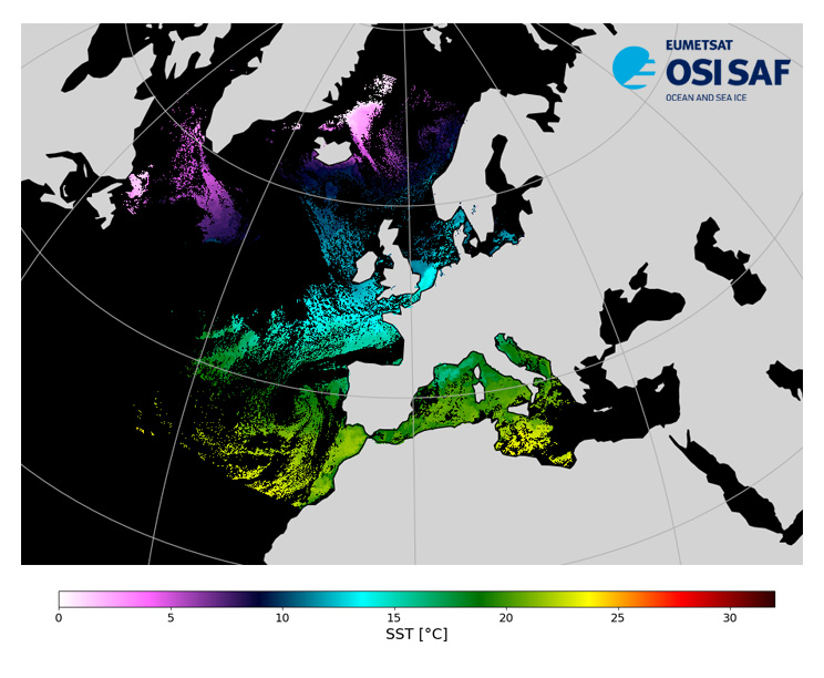
Level 3, four times a day, sub-skin Sea Surface Temperature derived from AVHRR on Metop satellites and VIIRS or AVHRR on NOAA and NPP satellites, over North Atlantic and European Seas and re-projected on a polar stereographic at 2 km resolution, in GHRSST compliant netCDF format. This catalogue entry presents Metop-B North Atlantic Regional Sea Surface Temperature. SST is retrieved from infrared channels using a multispectral algorithm and a cloud mask. Atmospheric profiles of water vapor and temperature from a numerical weather prediction model, Sea Surface Temperature from an analysis, together with a radiative transfer model, are used to correct the multispectral algorithm for regional and seasonal biases due to changing atmospheric conditions. The quality of the products is monitored regularly by daily comparison of the satellite estimates against buoy measurements. The product format is compliant with the GHRSST Data Specification (GDS) version 2.Users are advised to use data only with quality levels 3,4 and 5.
-

Level 2 sub-skin Sea Surface Temperature derived from AVHRR on Metop, global and provided in full-resolution swath (1 km at nadir), in GHRSST compliant netCDF format. The satellite input data has successively come from Metop-A, Metop-B and Metop-C level 1 data processed at EUMETSAT. SST is retrieved from AVHRR infrared channels (3.7, 10.8 and 12.0 µm) using a multispectral algorithm and a cloud mask. Atmospheric profiles of water vapor and temperature from a numerical weather prediction model, Sea Surface Temperature from an analysis, together with a radiative transfer model, are used to correct the multispectral algorithm for regional and seasonal biases due to changing atmospheric conditions. The quality of the products is monitored regularly by daily comparison of the satellite estimates against buoy measurements.The product format is compliant with the GHRSST Data Specification (GDS) version 2. Users are advised to use data only with quality levels 3,4 and 5.
-

Level 2 sub-skin Sea Surface Temperature derived from AVHRR on Metop, global and provided in full-resolution swath (1 km at nadir), in GHRSST compliant netCDF format. The satellite input data has successively come from Metop-A, Metop-B and Metop-C level 1 data processed at EUMETSAT. SST is retrieved from AVHRR infrared channels (3.7, 10.8 and 12.0 µm) using a multispectral algorithm and a cloud mask. Atmospheric profiles of water vapor and temperature from a numerical weather prediction model, Sea Surface Temperature from an analysis, together with a radiative transfer model, are used to correct the multispectral algorithm for regional and seasonal biases due to changing atmospheric conditions. The quality of the products is monitored regularly by daily comparison of the satellite estimates against buoy measurements.The product format is compliant with the GHRSST Data Specification (GDS) version 2. Users are advised to use data only with quality levels 3,4 and 5.
-

Level 3, four times a day, sub-skin Sea Surface Temperature derived from AVHRR on Metop satellites and VIIRS or AVHRR on NOAA and NPP satellites, over North Atlantic and European Seas and re-projected on a polar stereographic at 2 km resolution, in GHRSST compliant netCDF format. This catalogue entry presents Suomi-NPP North Atlantic Regional Sea Surface Temperature. SST is retrieved from infrared channels using a multispectral algorithm and a cloud mask. Atmospheric profiles of water vapor and temperature from a numerical weather prediction model, Sea Surface Temperature from an analysis, together with a radiative transfer model, are used to correct the multispectral algorithm for regional and seasonal biases due to changing atmospheric conditions. The quality of the products is monitored regularly by daily comparison of the satellite estimates against buoy measurements. The product format is compliant with the GHRSST Data Specification (GDS) version 2.Users are advised to use data only with quality levels 3,4 and 5.
-

Level 2 skin Sea Surface Temperature derived from IASI on Metop, global and provided in full-resolution swath (12 km at nadir to 40 km), in GHRSST compliant netCDF format. SST is retrieved using a multispectral algorithm and a cloud mask. Atmospheric profiles of water vapor and temperature from a numerical weather prediction model, Sea Surface Temperature from an analysis, together with a radiative transfer model, are used to correct the multispectral algorithm for regional and seasonal biases due to changing atmospheric conditions. The quality of the products is monitored regularly by daily comparison of the satellite estimates against buoy measurements. The product format is compliant with the GHRSST Data Specification (GDS) version 2. Users are advised to use data only with quality levels 3, 4 and 5.
-

Level 3 hourly sub-skin Sea Surface Temperature derived from Meteosat at 0° longitude, covering 60S-60N and 60W-60E and re-projected on a 0.05° regular grid, in GHRSST compliant netCDF format. The satellite input data has successively come from Meteosat level 1 data processed at EUMETSAT. SST is retrieved from SEVIRI using a multi-spectral algorithm and a cloud mask. Atmospheric profiles of water vapor and temperature from a numerical weather prediction model, Sea Surface Temperature from an analysis, together with a radiative transfer model, are used to correct the multispectral algorithm for regional and seasonal biases due to changing atmospheric conditions.The quality of the products is monitored regularly by daily comparison of the satellite estimates against buoy measurements. The product format is compliant with the GHRSST Data Specification (GDS) version 2. Users are advised to use data only with quality levels 3, 4 and 5.
 Catalogue PIGMA