LOCEAN
Type of resources
Available actions
Topics
Keywords
Contact for the resource
Provided by
Years
Formats
Representation types
status
Scale
Resolution
-
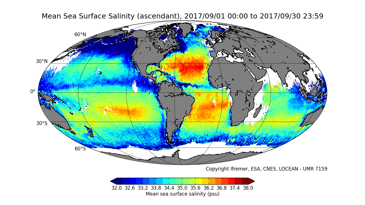
This product contains average 10 days & monthly salinity field based on L2P products, ascending and descending orbits being processed separately. ** This product is no longer available, see below **
-

The COriolis Ocean Dataset for Reanalysis (hereafter "CORA") product is a global dataset of in situ temperature and salinity measurements. The CORA observations comes from many different sources collected by Coriolis data centre in collaboration with the In Situ Thematic Centre of the Copernicus Marine Service (CMEMS INSTAC). The observation integrated in the CORA product have been acquired both by autonomous platforms (Argo profilers, fixed moorings , gliders , drifters, sea mammals) , research or opportunity vessels (CTDs, XBTs, ferrybox). From the near real time CMEMS In Situ Thematic Centre product validated on a daily and weekly basis for forecasting purposes, a scientifically validated product is created. It s a "reference product" updated on a yearly basis since 2007. This product has been controlled using an objective analysis (statistical tests) method and a visual quality control (QC). This QC procedure has been developed with the main objective to improve the quality of the dataset to the level required by the climate application and the physical ocean re-analysis activities. It provides T and S weekly gridded fields and individual profiles both on their original level with QC flags and interpolated level. The measured parameters, depending on the data source, are : temperature, salinity. The reference level of measurements is immersion (in meters) or pressure (in decibars). CORA contains historical profiles extracted from the EN.4 global T&S dataset, World Ocean Atlas, SeaDataNet, ICES and other data aggregators . The last version of the CORA product are also available freely from the Copernicus WEB site : - Global Ocean- CORA- In-situ Observations Yearly Delivery in Delayed Mode - Global Ocean- Delayed Mode gridded CORA- In-situ Observations objective analysis in Delayed Mode
-
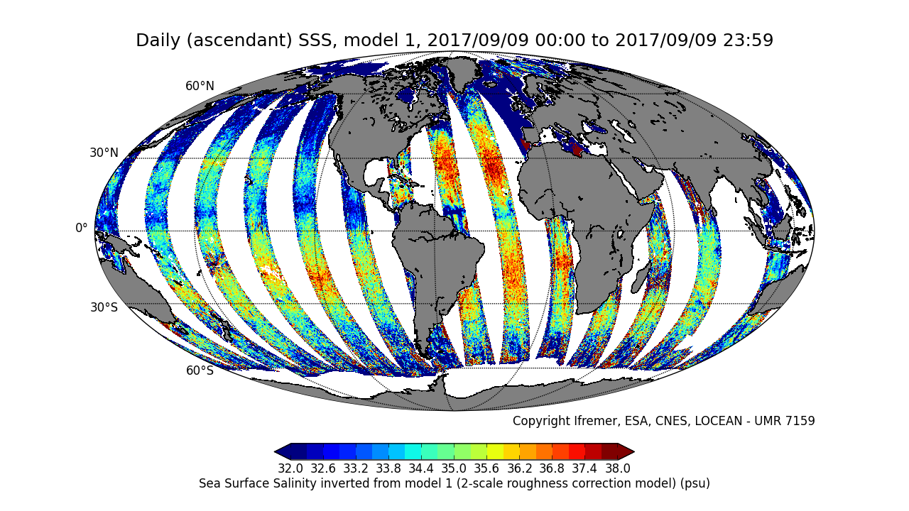
This product is an intermediate product, that provides, in daily files, SSS with qualification flags (associated confidence classes) which allow selecting valid data before averaging. Ascending and descending orbits are processed separately ** This product is no longer available, see below **
-

This product contains average 10 days & monthly salinity field based on L2P products, mixing ascending and descending orbits. ** This product is no longer available, see below **
-

Measurements by drifting surface buoys. This system is a drifting mooring consisting of a surface buoy fastened to a floating anchor by a cable (trip line, buoy rope). It has to monitor as precisely as possible the water volume in which the floating anchor is immersed. The surface buoys are traced by Argos satellites.
-
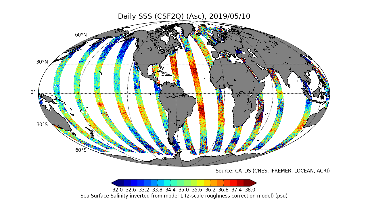
This product is an intermediate product, that provides, in daily files, SSS corrected from land-sea contamination and latitudinal bias. Ascending and descending orbits are processed separately
-

The Coriolis Ocean Dataset for Reanalysis for the Ireland-Biscay-Iberia region (hereafter CORA-IBI) product is a regional dataset of in situ temperature and salinity measurements. The latest version of the product covers the period 1950-2014. The CORA-IBI observations comes from many different sources collected by Coriolis data centre in collaboration with the In Situ Thematic Centre of the Copernicus Marine Service (CMEMS INSTAC). The observations integrated in the CORA-IBI product have been acquired both by autonomous platforms (Argo profilers, fixed moorings, gliders, drifters, sea mammals, fishery observing system from the RECOPESCA program), research or opportunity vessels ( CTDs, XBTs, ferrybox). This CORA-IBI product has been controlled using an objective analysis (statistical tests) method and a visual quality control (QC). This QC procedure has been developed with the main objective to improve the quality of the dataset to the level required by the climate application and the physical ocean re-analysis activities. It provides T and S individual profiles on their original level with QC flags. The reference level of measurements is immersion (in meters) or pressure (in decibars). It is a subset on the IBI (Iberia-Bay-of-Biscay Ireland) of the CMEMS product referenced hereafter. The main new features of this regional product compared with previous global CORA products are the incorporation of coastal profiles from fishery observing system (RECOPESCA programme) in the Bay of Biscay and the English Channel as well as the use of an historical dataset collected by the Service hydrographique de la Marine (SHOM).
-
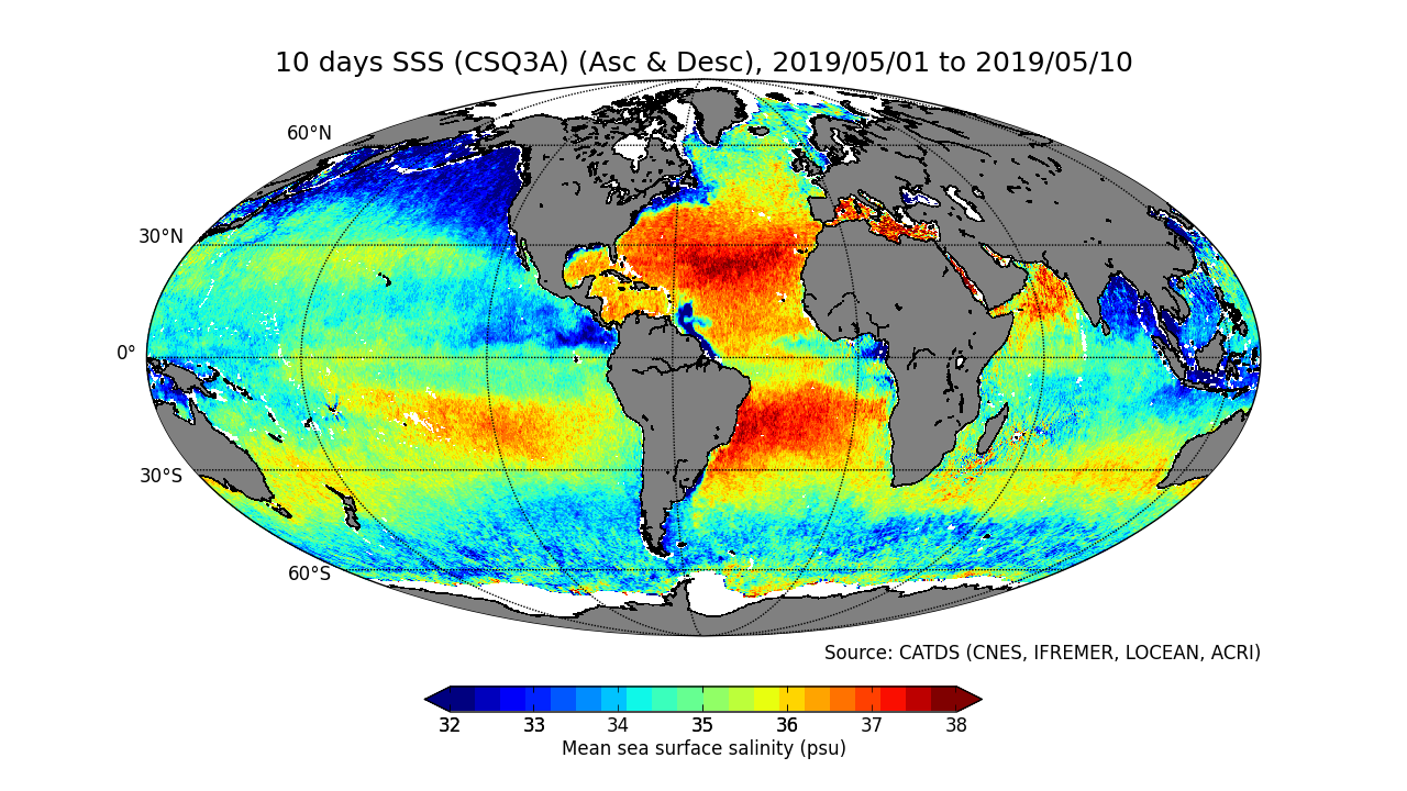
This product contains average 10 days & monthly salinity field corrected from land-sea contamination and latitudinal bias, based on L2Q products, mixing ascending and descending orbits.
-
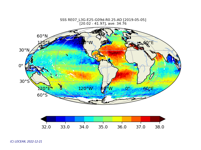
This product contains daily salinity fields from a 9 days temporal gaussian average, corrected from land-sea contamination and latitudinal bias, based on L2Q products, mixing ascending and descending orbits.
-
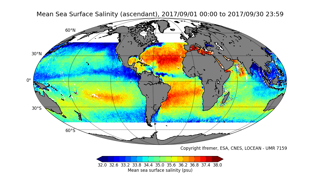
This product contains average 10 days & monthly salinity field corrected from land-sea contamination and latitudinal bias, based on L2Q products, ascending and descending orbits being processed separately. ** This product is no longer available, see below **
 Catalogue PIGMA