 Catalogue PIGMA
UBO, Laboratoire d’Océanographie Physique et Spatiale, France
Type of resources
Available actions
Topics
Keywords
Contact for the resource
Provided by
Years
Formats
-
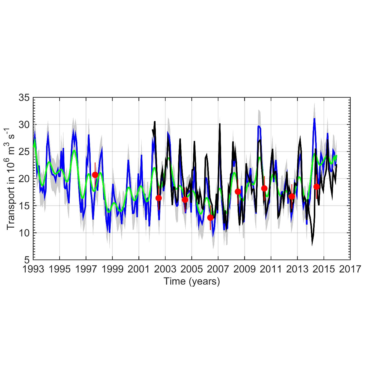
This data set provides a monthly time series of the upper limb of the Meridional Overturning Circulation (MOC) intensity at the A25 Greenland-Portugal OVIDE line from 1993 to 2015. The MOC was derived by combining AVISO altimetry with ISAS temperature and salinity data. The reader is referred to Mercier et al. (2015, Progress in Oceanography) for a full description of the method.
-
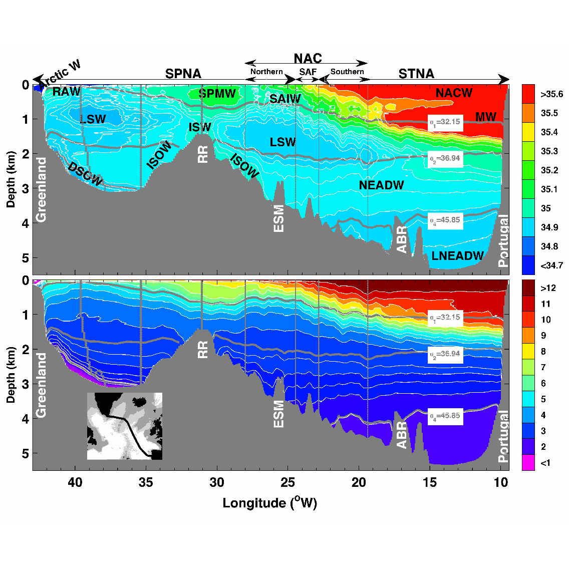
This data set contains the gridded hydrographic and transport data for the biennial Go-Ship A25 Greenland–Portugal OVIDE section from 2002 to 2012. The properties and transports are mapped on a 7km x 1m grid. Using a common grid facilitates the comparison between the different occupations of the line and the averaging. This data set was used in Daniault et al. (2016, Progress in Oceanography) to which the reader is referred for a description of the gridding method.